
Floods – Changes Over Time
Australia has only just recently suffered the worst flooding in years, with large areas of the East Coast under water. Brisbane was hit very hard with high waterlevels over days.
ABC-News has put together a coverage story showing in detail the impact of the flooding before and after. It is a sort of time warp representation between two given dates. Click HERE for the slider version 01 and HERE for the slider version 02.
The visualisation is based on date from the nearmap service. They are providing detailed resolution time aerial maps, just like google maps does but with an integrated time slider. Google offers a similar tool in Google Earth to see older imagery, but nearmap offers more and much shorter timespans between the dates. So it happens they also have imagery ready from right during the flooding.
Rosalie Village [Click for original nearmap]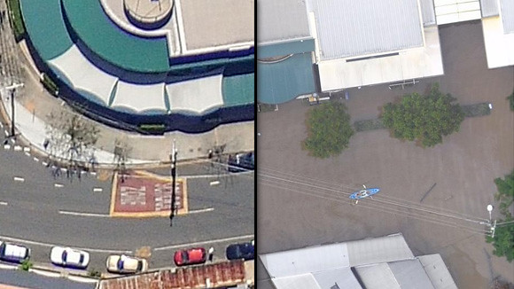
Cleverly the imagery is overlaid and allows to drag the before stage to reveil the after, showing water everywhere. Of course the images line up perfectly with the difference of what happend to the place in the mean time.
Milton (Lang Park) [Click for original nearmap]

Floating pallets in Rocklea industrial estate [Click for original nearmap]

In the original representation this obviously has the wow effect for discovering whats underneath and then covering it up again. This is great interactive visualisation. The fasciantion lies in the hidden part.
HMAS Diamantina in ‘dry dock’ at South Bank [Click for original nearmap]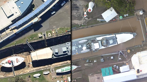
Two men in a floating ‘spa’ in Chelmer [Click for original nearmap]

Via infosthetics