GeoComputation: A Practical Primer
 GeoComputation: A Practical Primer, edited by Profs Chris Brunsdon and Alex Singleton, has just been published by SAGE.
The book acts both as a reference guide to the field and as a guide to help you get to know aspects of it. Each chapter includes a worked example with step-by-step instructions.
Each chapter has a different author, and includes topics such as spatial data visualisation with R, agent-based modelling, kernel density estimation, spatial interaction models and the Python Spatial Analysis library, PySAL. With 18 chapters, the book runs to over 300 pages and so has the appropriate depth to cover a diverse, active and fast-evolving field.
I wrote chapter in the book, on open source GIS. I focused particularly on QGIS, as well as mentioning PostGIS, Leaflet, OpenLayers (2) and other parts of the modern open source “geostack”. My example describes how to build a map, in QGIS, of London’s railway “not-spots” – places which are further than a mile from a railway station, using open data map files, mainly from the Ordnance Survey. With the guide, you can create a map like the one below:
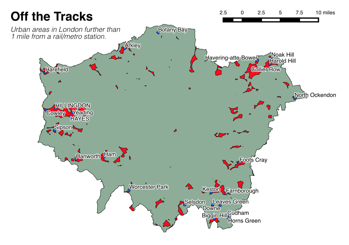
That little spot on its own in central-ish London, by the way, is part of Burgess Park, near Peckham.
The book has only just been published and I was able to slip in brand new screenshots (and slightly updated instructions) just before publication, as QGIS 2.6 came out late last year. So, the book is right up to date, and as such now is a great time to get your copy!
It’s available now in paperback on Amazon: Geocomputation: A Practical Primer.