

Crossrail Station Footprints
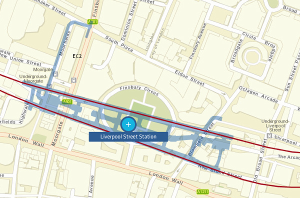
We’ve featured Crossrail’s official construction map before, when it was showing the progress of the various TBMs (tunnel boring machines) drilling through London, but with the tunnels themselves now burrowed, it’s received a welcome update – if you zoom right in, you can now see the shape and extent of the underground stations. And they are HUGE, with some of the central London ones having different tube stations at each end. For example, the Liverpool Street Crossrail station’s western entrance is actually at Moorgate, the next tube station along:
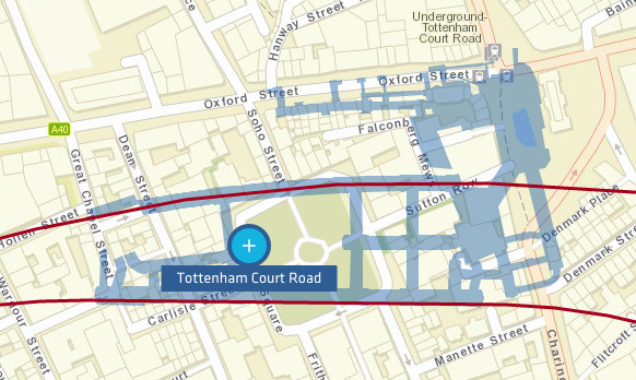
Tottenham Court Road Crossrail Station is a particularly complex setting of tunnelling, as it has to link with both the Central and Northern lines there, while the station itself is some way to the south of both of them. There’s also some short links for integrating with a future Crossrail 2 line, and the map shows the huge new ticket hall which has already opened – with passages to Crossrail blocked with blue walls until opening day in late 2018:
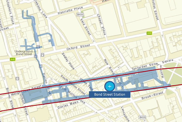
Bond Street Crossrail Station also lies to the south of the existing tube station, so includes a link snaking north to it, as well as some additional mysterious tunnels even further north – possibly capacity enhancement for the existing Jubilee Line part of the station?
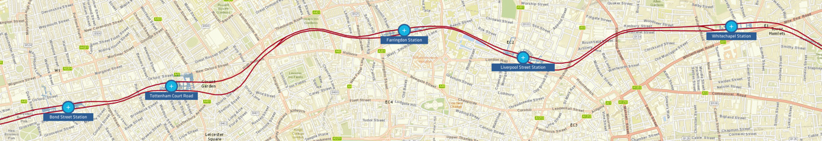
Here’s the general route of the Crossrail tunnels through central London:
Explore the interactive map here – with the tunnel detail appearing as you zoom right in.
Images from the Crossrail website. The maps use the Esri ArcGIS Online system. You can toggle on/off archaeological finds and current works, on the map.