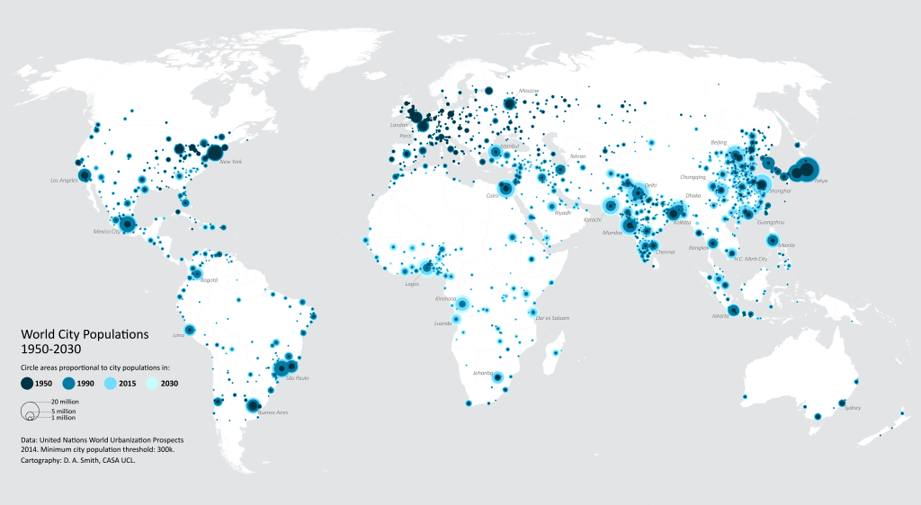
Environment & Planning Featured Graphic: World City Populations Time-Series Map
The World City Populations Interactive Map is now available as a static map, and has been published as a Featured Graphic in Environment and Planning A. The EPA article includes details on the UN World Urbanization Prospects data, and the methods used to create the map.
For a high resolution version of the static map, click below-
![]()

