
TfL’s Corporate Archives
The Corporate Archives division of Transport for London recently held a short internal exhibition at their headquarters at Palestra, called “Mapping London” and showcasing new and old maps of London’s transport from the archive.
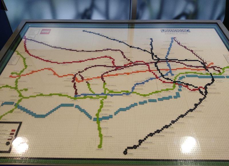
Amongst the highlights included this Lego historic tube map. The Lego is modern but the map was one of the last pre-Beck (pre-straight lines) map of the tube network, from the early 1930s. It contrasts with the light-up Lego map of the modern network that was recently installed in the new Lego shop on Leicester Square.
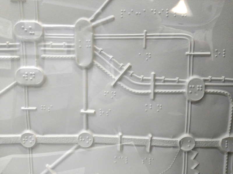
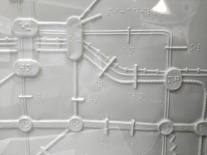
I also liked this experimental Braille map of the tube network, from the 1990s. As well as the big station areas with their names written in Braille, the lines themselves have different patterns, a little like physical version of the current black & white map of the network, an adaptation of which was used in this colour-blind tube map.
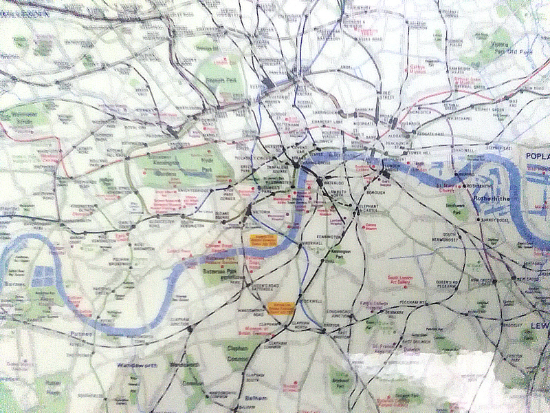
Finally there was a glimpse of a modern geographical map of the tube network I hadn’t seen before. Dating from the early 1970s, it shows the network and its actual relation with the rest of London, and can be compared with the more modern London Connections map. Unfortunately the print was very small and I wasn’t able to capture a good image of it:
Thank you to TfL’s Press Office for inviting Mapping London to the exhibition.