
Landmarks of London
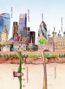
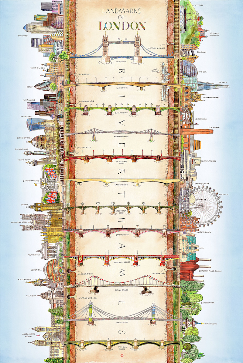
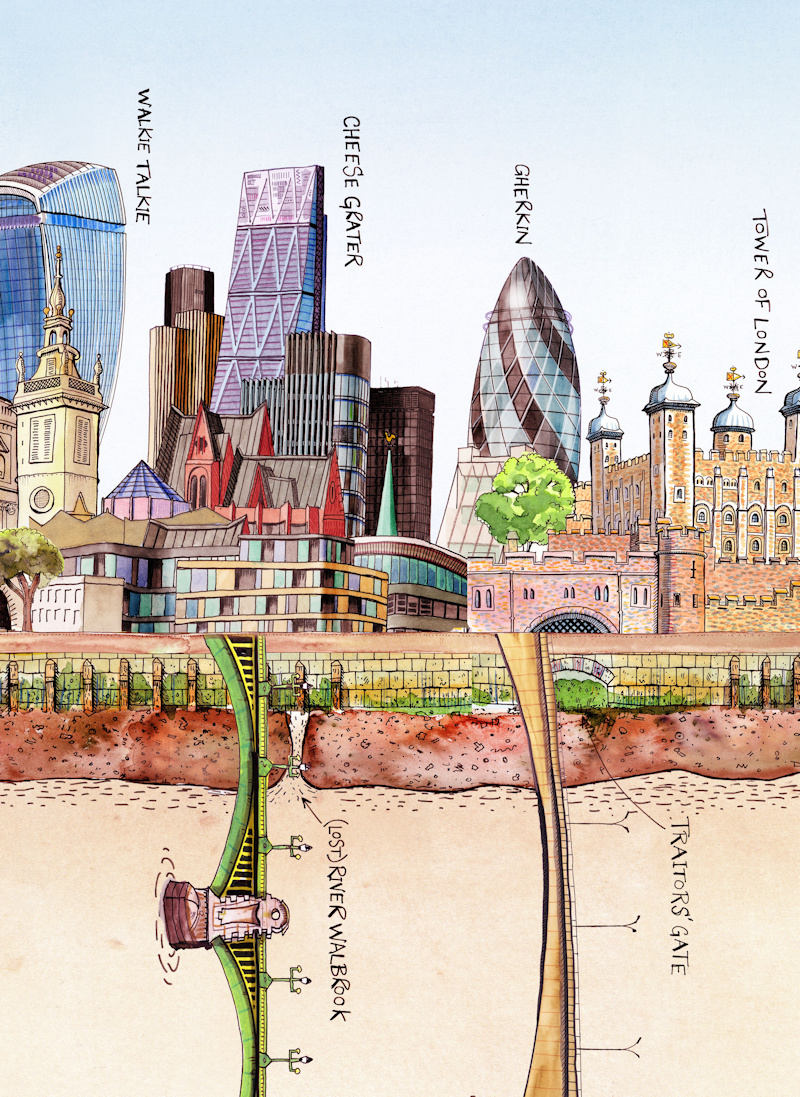
We featured Bridges of London earlier this week. However, the public realm relating to the Thames is more than the river itself and the bridges crossing it. One of London’s defining features, in recent times, as the Thames has cleaned and the spaces beside it have become less-traffic choked, is its riverside frontage. This lovely new illustrated map by Martin Thompson focuses both on the bridges and on the public realm beside the river. Running from Canary Wharf and Greenwich in the east, to Battersea Park in the west, it includes beautiful sketches of the 12 foot-accessible bridges in this section, the iconic buildings alongside, and other little details, such as the lost (that is, now underground) smaller rivers that meet the Thames in this central part of the capital. Martin redraws the river as a straight line of fixed width, with the buildings on either side flaring out and away from it. Most of London’s main tourist attractions, are in fact, not far from the River Thames, so the sketch encapsulates many of London’s most notable landmarks.
Intriguingly, Martin uses brown to show the river, rather than the usual blue. You would think this would result in muddy, murky illustration, however it turns it works really well, contrasting with the colour and detail of the riverbanks, and the blue of the skies beyond, on either side.
Martin has plans to print to order giclee prints of the work, contact him via his website for further details.
Images courtesy of the artist.