
Usability, SatNavs and Which?
The Consumers’ Association Which? magazine is probably not the first place to turn to when you look for usability studies. Especially not if you’re interested in computer technology – for that, there are sources such as PC Magazine on the consumer side, and professional magazines such as Interactions from Association for Computing Machinery (ACM) Special Interest Group on Computer-Human Interaction (SIGCHI).
And yet…
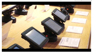
Over the past few years, Which? is reviewing, testing and recommending Satnavs (also known Personal Navigation Devices – PNDs). Which? is an interesting case because it reaches over 600,000 households and because of the level of trust that it enjoys. If you look at their methodology for testing satnavs , you’ll find that it does resemble usability testing – click on the image to see the video from Which? about their methodology. The methodology is more about everyday use and the opinion of the assessors seems to play an important role.
Professionals in geographical information science or human-computer interaction might dismiss the study as unrepresentative, or not fitting their ways of evaluating technologies, but we need to remember that Which? is providing an insight into the experience of the people who are outside our usual professional and social context – people who go to a high street shop or download an app and start using it straightaway. Therefore, it’s worth understanding how they review the different systems and what the experience is like when you try to think like a consumer, with limited technical knowledge and understanding of maps.
There are also aspects that puncture the ‘filter bubble‘ of geoweb people – Google Maps are now probably the most used maps on the web, but the satnav application using Google Maps was described as ‘bad, useful for getting around on foot, but traffic information and audio instructions are limited and there’s no speed limit or speed camera data‘. Waze, the crowdsourced application received especially low marks and the magazine noted that it ‘lets users share traffic and road info, but we found its routes and maps are inaccurate and audio is poor‘ (both citations from Which? Nov 2012, p. 38). It is also worth reading their description of OpenStreetMap when discussing map updates, and also the opinions on the willingness to pay for map updates.
There are many ways to receive information about the usability and the nature of interaction with geographical technologies, and some of them, while not traditional, can provide useful insights.

![]()