SmellyMaps
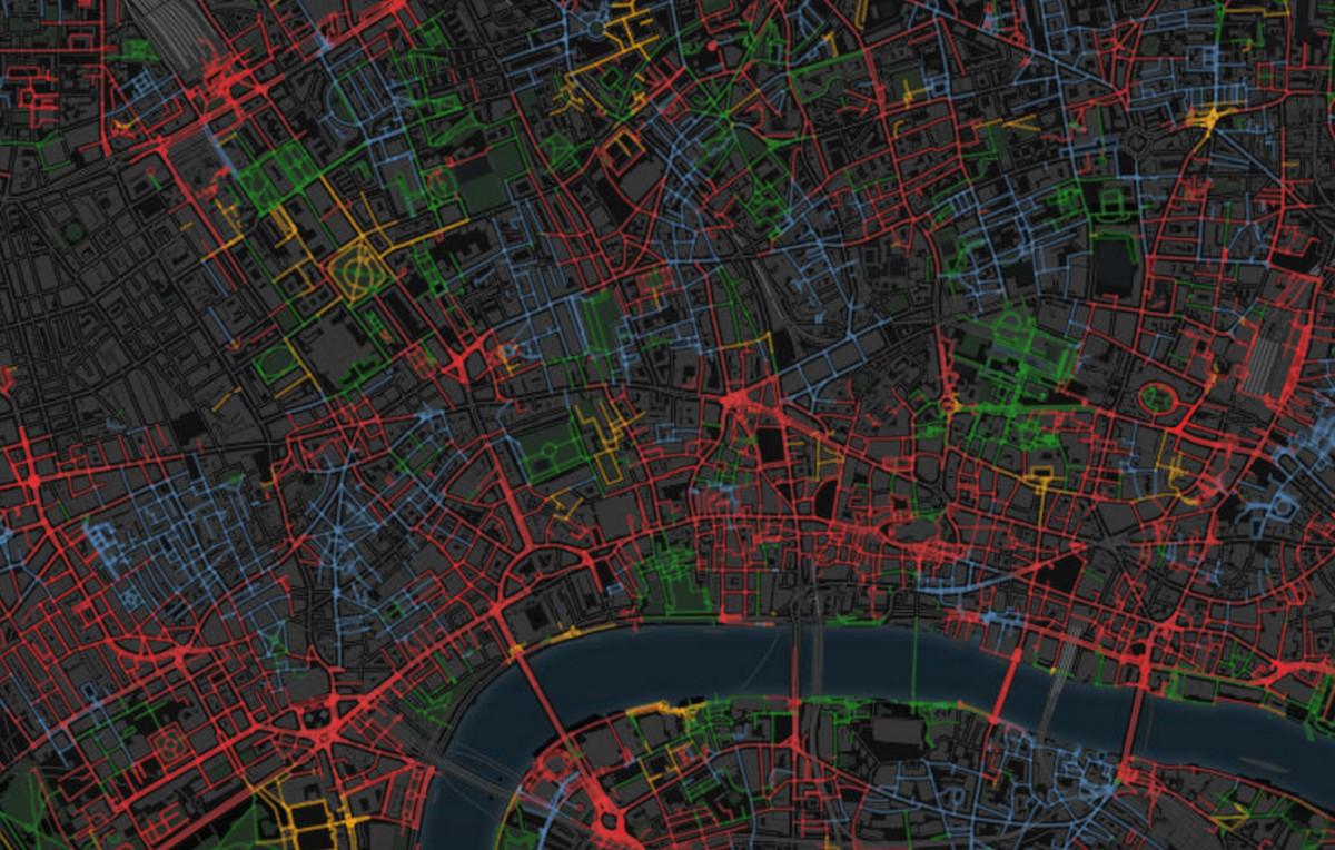
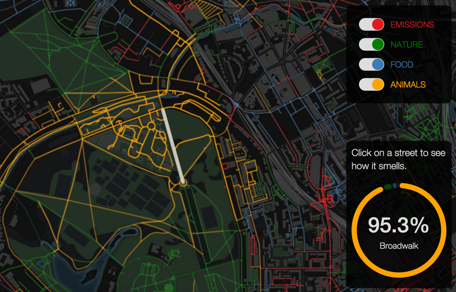
SmellyMaps reveals the “olfactory footprint of London” – the streets which are dominated by traffic fumes, the animal smells emanating out from London Zoo, and the influence of parks and greenspaces on London’s scent experience. Streets are measured for four smell groupings – emissions (coloured red on the map), nature (green), food (blue) and animals (yellow), the map colouring each road by the most dominant of the four. Clicking on the segment reveals the measurements. The results are attractively presented on a background map. SmellyMaps is an output from Bell Labs’ Daniele Quercia, based partly on many urban walks and surveys by RCA student Kate McLean.
I wonder how far the smell footprint of Lush cosmetic shops spreads?
From a presentation by Daniele.