
Tweet City: Building Heights by Number of Tweets Movie (London)
What if London’s buildings grew according to the amount of data they generate? Stephan Hügel (@urschrei) and Flora Roumpani (@en_topia) two of our PhD students from The Bartlett Centre for Advanced Spatial Analysis, University College London, have been working on a system to read in twitter data to CityEngine and link the geo locations to building outlines.
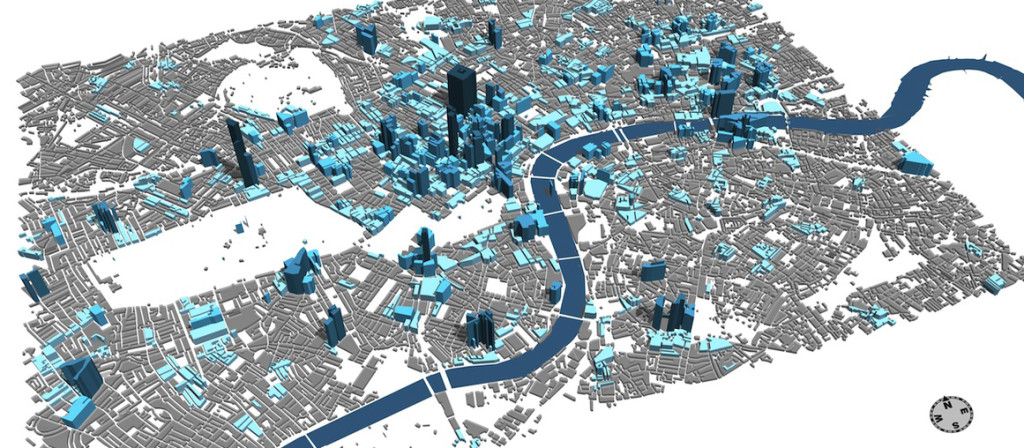
Twitter Data linked to Building Footprints
The video below is the first step in an approach to visualising an urban landscape using the objects that already exist in it; instead of abstract swirling points, bars, and artefacts hovering in the sky, the buildings themselves become the medium by which the data generated in and around them are made visible:
For more info head over to http://en-topia.blogspot.co.uk/2013/07/tweetcity-re-populating-london.html and to download source code: http://urschrei.github.io/CityEngine-…


