

Data Maps with Force Layout
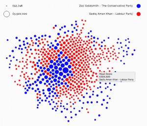
Alexander Brett has created this interactive map of London using the D3 visualisation framework and its “Force Layout” view. This places the data points (London ward centroids) at their geographic origin, and then applies a series of competing forces, as if the points are connected by a mesh of springs, to subtly adjust the locations […]
Continue reading »