 |
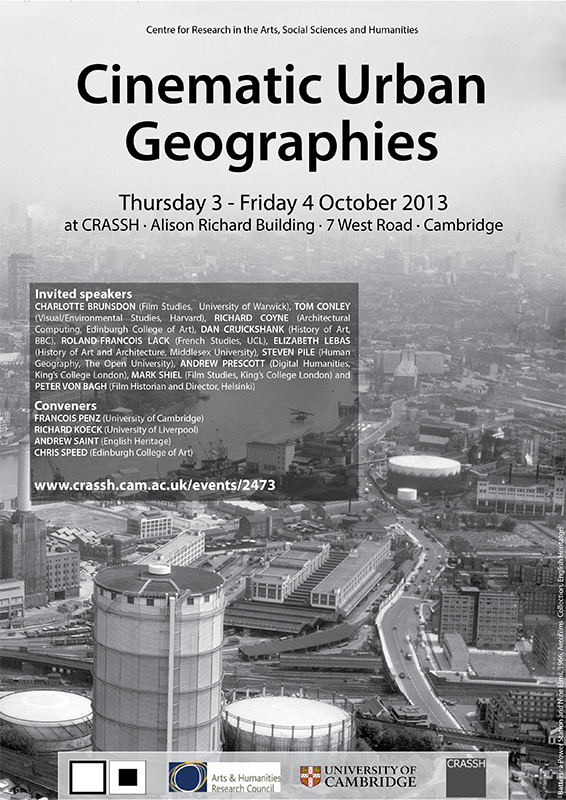
| Image by Networking City/ Cover page of the research paper |
After 6 months efforts, the research paper ‘The Study of Housing Renewal for Neighbourhood Regeneration in Ansan’ was submitted to Centre for Creating Livable Village in Ansan, one of famous local NGO in South Korea, by this blog. The aim of the research is to understand the history of urban development of Ansan, a satellite city of Seoul, to identify the city’s characteristics by comparison with other cities in Korea, to investigate the present conditions of four low-rise housing areas through a field research and provide a planning guideline of neighbourhood regeneration for the NGO and the city government.
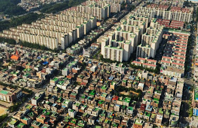 |
| Image is taken from Naver/ The collision between high-rise apartments and low-rise housings
|
Ansan is a city in Gyeonggi Province, South Korea and a part of the Seoul Metropolitan Area. Originally, it was a small town on the coast of Yellow Sea until 1960’s. In 1970’s, Korean national government decided to develop it for the industrial city that contained small polluted factories. The small town was rapidly changed its shape as the first modern designed city (it means grid system) in Korea and lots of people have moved to the city for jobs and economic benefits since 1980’s.
At one time, Ansan was a symbol of successful economic achievement of Korea, however, now the city is facing a hard time that the numbers of closed factory are increasing and inextricable social problems related to the declining industry such as unstable employment, low income family, high residential mobility, poor residential environment and weak community networks.
Even though many researchers have been interested in this city, there was no challenge to clarify the relationship between the urban development process of Ansan and its impact on the change of residential areas. Also, there is no appropriate strategy to reorganize old, high dense, low-rise housing areas that the residents cannot support money for the redevelopment by high-rise apartments which has been the main development tool in Korea.
 |
| Image by Networking City/ The area and population of five cities
|
 |
Image by Networking City/ The population structures of five cities
|
Therefore, Centre for Creating Livable Village, an independent organization for improving environment of residential areas based on local governments’ support, as a leading local NGO, set up a plan with young researchers to foster practical framework and in-detail analysis rather than grandiloquent words. The research paper is the first outcome of the plan.
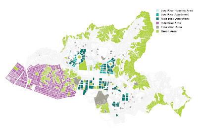 |
Image by Networking City/ The diagram of urban programme in Ansan
|
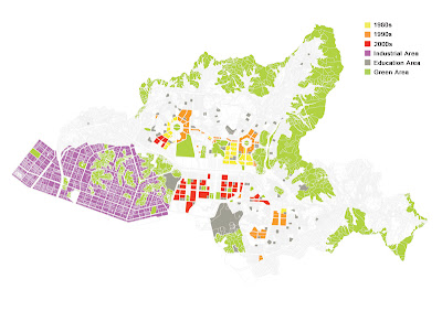 |
Image by Networking City/ The diagram of housing development process in Ansan
|
The research is composed of six chapters; Introduction, The characteristics of urban development and the change of housing areas in Ansan, The comparative analysis of urban characteristics between Ansan and four neighbour cities, The case study of four low-rise housing areas in Ansan, The strategy for neighbourhood regeneration and Conclusion.
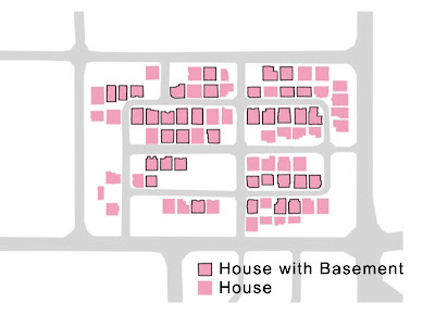 |
Image by Networking City/ The diagram of house that people live in basement in Bono-dong (One of low-rise housing area in Ansan)
|
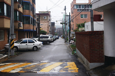 |
Image by Networking City/ The street view of Seonbu-dong (One of low-rise housing area in Ansan)
|
It will be used as a policy reference for the NGO and the Ansan city government, and hope it could be a tangible steppingstone for the future regeneration plan of the city.
Continue reading »