- Visualization and exploratory spatial data analysis
- Space time modelling
- Spatial algorithms
- Spatial regression and statistics
- Enabling interactions through the use of neogeography ”
In the book I contributed a chapter on “
Agent-based Models and Geographical Information Systems“. Such a topic might not come as a surprise to readers of this blog but I essentially wanted to showcase a series of applications that we have been working on here at
George Mason University and moreover, provide a general introduction to agent-based modeling (ABM) and how to link it to geographical information.
The main argument of the chapter is that the ABM paradigm provides a mechanism for understanding the effects of interactions of individuals and through such interactions emergent structures develop, both in the social and physical environment. By coupling agent-based models to geographical information systems (GIS), spatially explicit agent-based models can be created exploring the complexities of our world from the bottom-up.
 |
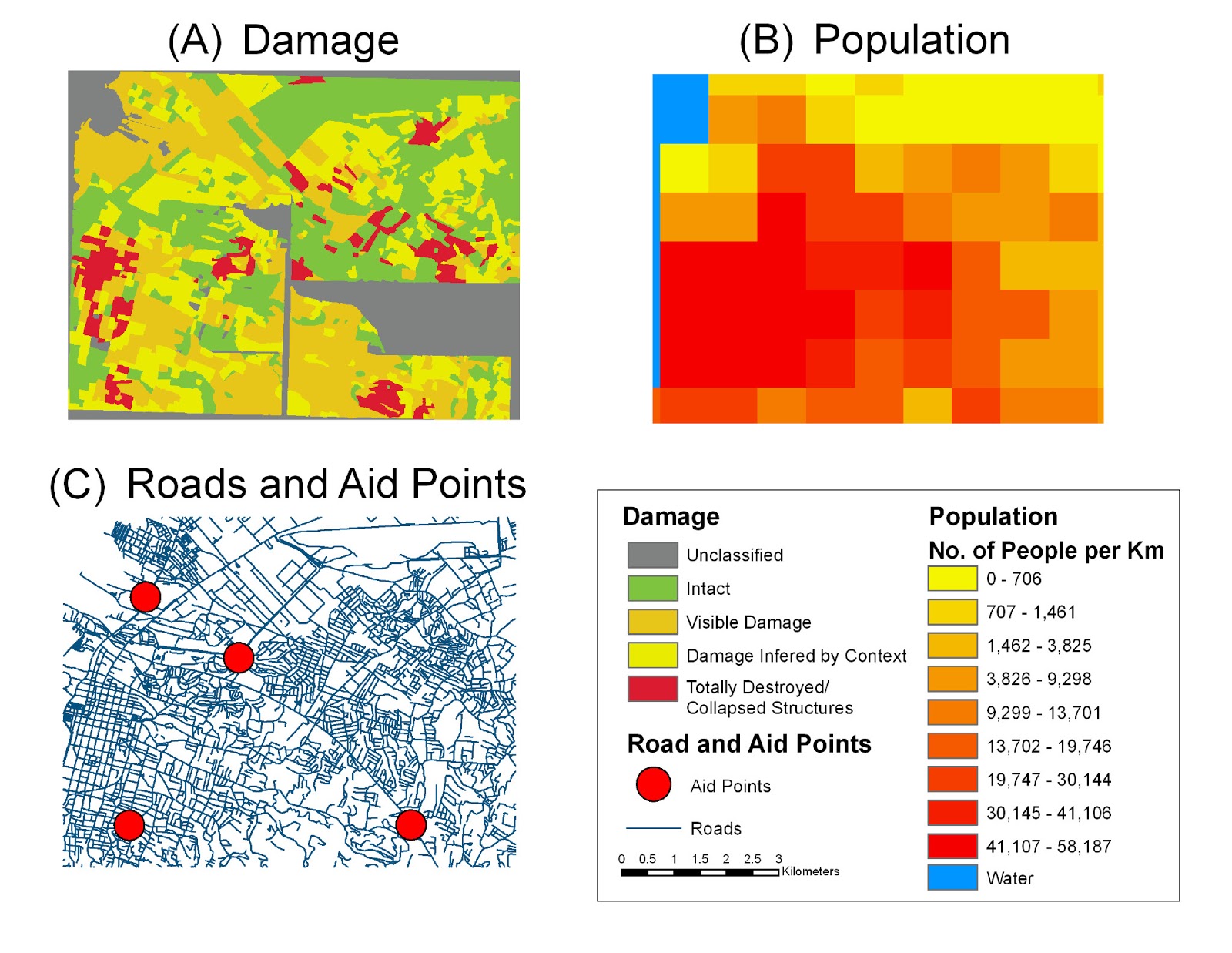
Representing the world as a series of layers of fixed and
non-fixed objects (adapted from Benenson and Torrens, 2004). |
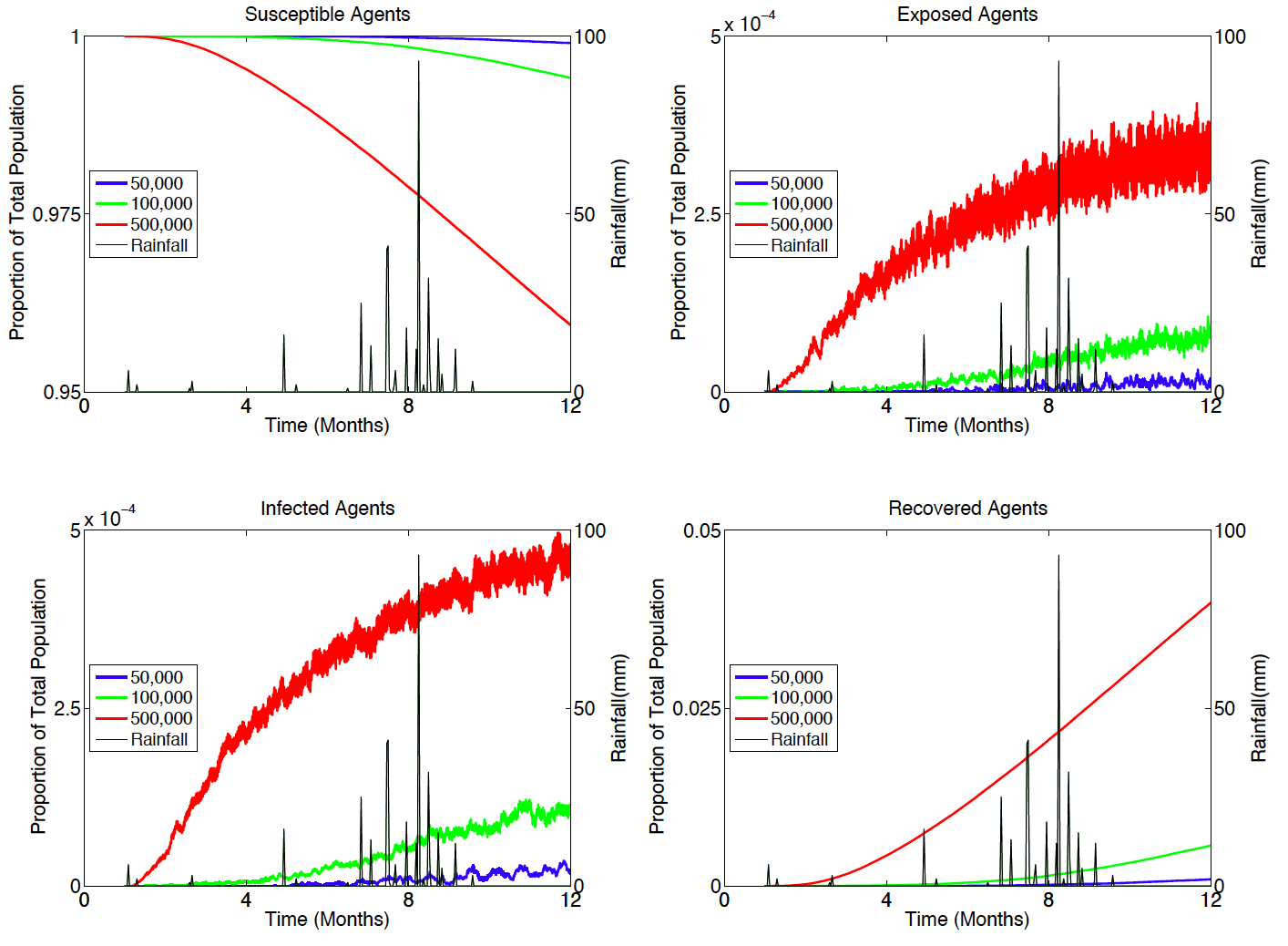
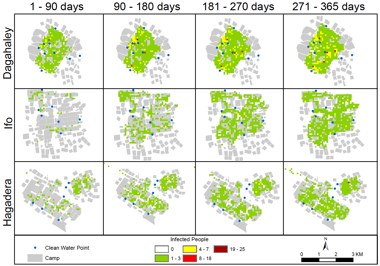
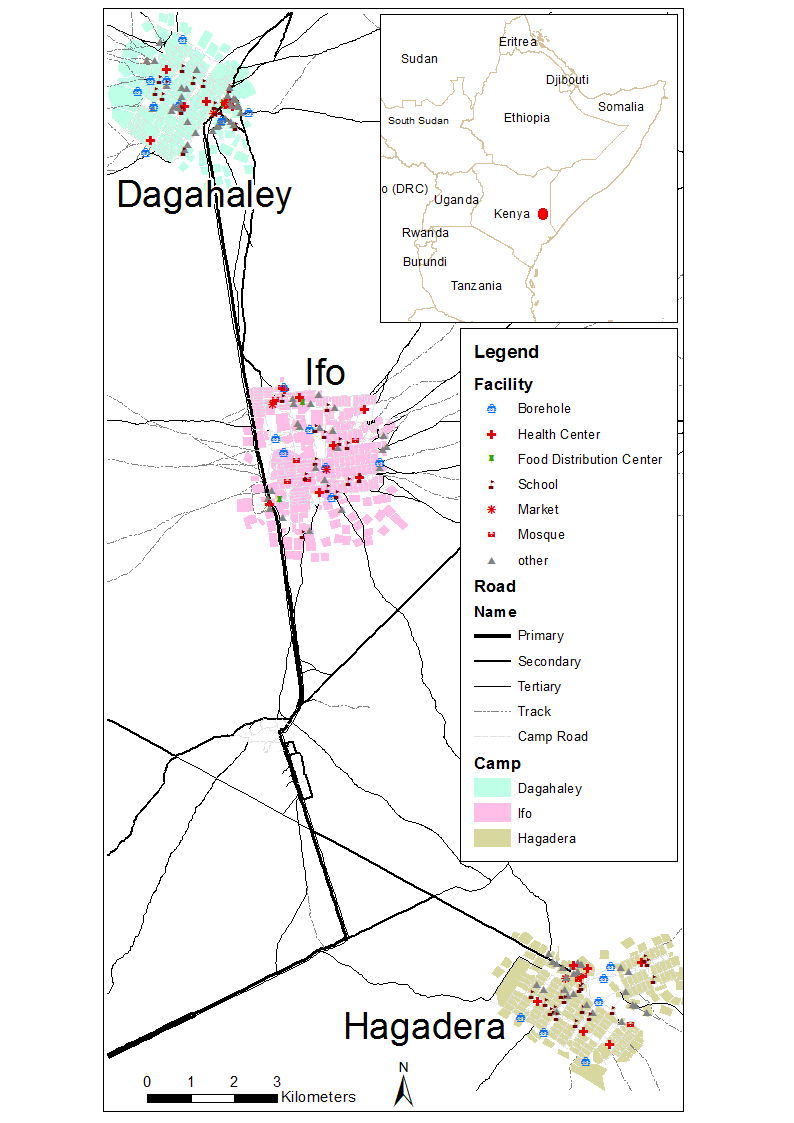
The chapter therefore introduces agent-based models to those interested in geocomputational methods, argues why such models should be used to study geographical problems before discussing how one can use GIS to create geographical explicit agent-based models. Through a series of examples we demonstrate how raster or vector spatial data can be used to model various aspects of our daily lives from that of the micro movement of pedestrians over seconds and minutes, to that of the macro patterns of urban growth over years and decades. By integrating spatial data and agent-based models at different spatial and temporal scales, such a modeling approach provides the flexibility to aid social scientists to explore the complex world that we inhabit.
Many of the models discussed in the chapter were either created in
NetLogo or
MASON. If you look at my
research page you can find the source code to most of these models.
 |
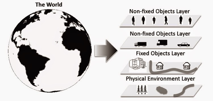
| A sample of application domains for spatial agent-based models discussed in the chapter. |
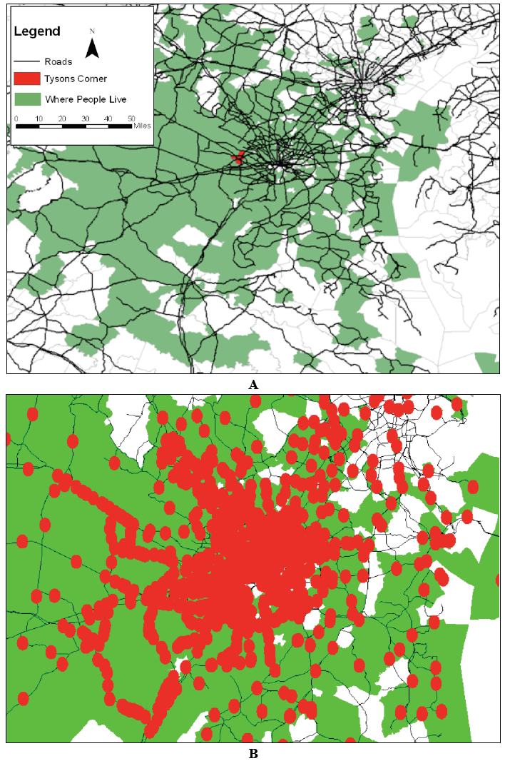 |
A simple example using MASON on how Agent-based models can be to used explore rush hour congestion:
(A): Road and census data used for model inputs. (B) Zoomed in section of A with agents (red circles)
moving towards Tyson’s Corner and causing traffic jams. |
Reference Cited:
Benenson, I. and Torrens, P.M. (2004), Geosimulation: Automata-Based Modelling of Urban Phenomena, John Wiley & Sons, London, UK.
Full Reference to Chapter:
Crooks, A.T. (2015), Agent-based Models and Geographical Information Systems, in Brunsdon, C. and Singleton, A. (eds.),
Geocomputation: A Practical Primer, Sage, London, UK, pp. 63-77. (
pdf)
Happy reading, and if you cannot find the models discussed in the chapter, feel free to drop me an email and I can point you in the right direction.
Continue reading »