A Review of High and Very High Resolution Remote Sensing Approaches for Detecting and Mapping Slums

Regular readers of this site might of noticed that we have an interest in slums. In the past this has focused on modeling them from an agent-based perspective, comparing volunteered geographical information to more authoritative data on slums, to that …

Continue reading »

Smart Cities in IEEE Pervasive Computing

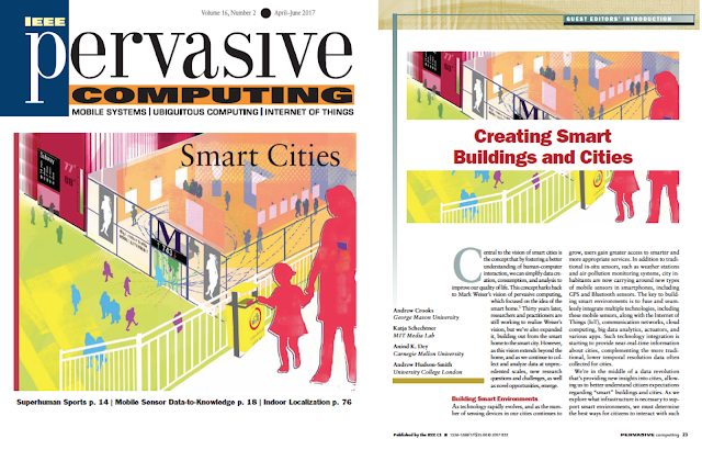
We are excited to announce that the special issue that we organized for IEEE Pervasive Computing is now out. In the special issue entitled “Smart Cities” and demonstrates the state of the art of pervasive computing technologies that collect, monitor, and analyze various aspects of urban life. The articles and departments in the special issue highlight the coming revolution in urban data via some of the different approaches researchers are taking to build tools and applications to better inform decision making (to reduce energy consumption or improve visitor flows, for example). Such research will be critical to setting goals for sustainable urban development within different global contexts. We need to better understand cities and their underlying systems if we want to improve the quality of urban life. To this end, in the special issue we have an introduction (editorial) followed by a number of articles, an interview and a research spotlight:
We hope you enjoy them. Thank you for the authors who submitted papers, the reviewers, Rob Kitchen for giving an interview and Barbara Lenz and Dirk Heinrichs for discussing their research. Lastly, we would also like to thank the IEEE Pervasive Computing team for ensuring that the special issue came to fruition.

Full Reference to the Introduction: 

Crooks, A.T., Schechtner, K., Day, A.K and Hudson-Smith, A (2017), Creating Smart Buildings and Cities, IEEE Pervasive Computing, 16 (2): 23-25. (pdf)

Continue reading »

New Paper: User-Generated Big Data and Urban Morphology

Continuing our work with crowdsourcing and geosocial analysis we recently had a paper published in a special issue of the  Built Environment journal entitled “User-Generated Big Data and Urban Morphology.”
The theme of the special issue is: “Big Data and the City” which was guest edited by Mike Batty and includes 12 papers.  To quote from the website

“This cutting edge special issue responds to the latest digital revolution, setting out the state of the art of the new technologies around so-called Big Data, critically examining the hyperbole surrounding smartness and other claims, and relating it to age-old urban challenges. Big data is everywhere, largely generated by automated systems operating in real time that potentially tell us how cities are performing and changing. A product of the smart city, it is providing us with novel data sets that suggest ways in which we might plan better, and design more sustainable environments. The articles in this issue tell us how scientists and planners are using big data to better understand everything from new forms of mobility in transport systems to new uses of social media. Together, they reveal how visualization is fast becoming an integral part of developing a thorough understanding of our cities.”

Table of Contents

In our paper we discuss and show how crowdsourced data is leading to the emergence of alternate views of urban morphology that better capture the intricate nature of urban environments and their dynamics. Specifically how such data can provide us information pertaining to linked spaces and geosocial neighborhoods. We argue that a geosocial neighborhood is not defined by its administrative boundaries, planning zones, or physical barriers, but rather by its emergence as an organic self-organized social construct that is embedded in geographical spaces that are linked by human activity. Below is the abstract of the paper and some of the figures we have in it which showcase our work.

“Traditionally urban morphology has been the study of cities as human habitats through the analysis of their tangible, physical artefacts. Such artefacts are outcomes of complex social and economic forces, and their study is primarily driven by traditional modes of data collection (e.g. based on censuses, physical surveys, and mapping). The emergence of Web 2.0 and through its applications, platforms and mechanisms that foster user-generated contributions to be made, disseminated, and debated in cyberspace, is providing a new lens in the study of urban morphology. In this paper, we showcase ways in which user-generated ‘big data’ can be harvested and analyzed to generate snapshots and impressionistic views of the urban landscape in physical terms. We discuss and support through representative examples the potential of such analysis in revealing how urban spaces are perceived by the general public, establishing links between tangible artefacts and cyber-social elements. These links may be in the form of references to, observations about, or events that enrich and move beyond the traditional physical characteristics of various locations. This leads to the emergence of alternate views of urban morphology that better capture the intricate nature of urban environments and their dynamics.”

Keywords: Urban Morphology, Social Media, GeoSocial, Cities, Big Data.

City Infoscapes – Fusing Data from Physical (L1, L2), Social, Perceptual (L3) Spaces to Derive Place Abstractions (L4) for Different Locations (N1, N2).
Recreational Hotspots Composed of “Locals” and “Tourists” with Perceived Artifacts Indicating “Use” and “Need”. (A) High Line Park (B) Madison Square Garden.


Moving from Spatial Neighborhoods to Geosocial Neighborhoods via Links.

The Emergence of Geosocial Neighborhoods after the in the
Aftermath of the 2013 Boston Marathon Bombing

Full  Reference: 

Crooks, A.T., Croitoru, A., Jenkins, A., Mahabir, R., Agouris, P. and Stefanidis A. (2016). “User-Generated Big Data and Urban Morphology,”  Built Environment, 42 (3): 396-414. (pdf)

Continue reading »

New Paper: User-Generated Big Data and Urban Morphology

Continuing our work with crowdsourcing and geosocial analysis we recently had a paper published in a special issue of the  Built Environment journal entitled “User-Generated Big Data and Urban Morphology.”
The theme of the special issue is: “Big Data and the City” which was guest edited by Mike Batty and includes 12 papers.  To quote from the website

“This cutting edge special issue responds to the latest digital revolution, setting out the state of the art of the new technologies around so-called Big Data, critically examining the hyperbole surrounding smartness and other claims, and relating it to age-old urban challenges. Big data is everywhere, largely generated by automated systems operating in real time that potentially tell us how cities are performing and changing. A product of the smart city, it is providing us with novel data sets that suggest ways in which we might plan better, and design more sustainable environments. The articles in this issue tell us how scientists and planners are using big data to better understand everything from new forms of mobility in transport systems to new uses of social media. Together, they reveal how visualization is fast becoming an integral part of developing a thorough understanding of our cities.”

Table of Contents

In our paper we discuss and show how crowdsourced data is leading to the emergence of alternate views of urban morphology that better capture the intricate nature of urban environments and their dynamics. Specifically how such data can provide us information pertaining to linked spaces and geosocial neighborhoods. We argue that a geosocial neighborhood is not defined by its administrative boundaries, planning zones, or physical barriers, but rather by its emergence as an organic self-organized social construct that is embedded in geographical spaces that are linked by human activity. Below is the abstract of the paper and some of the figures we have in it which showcase our work.

“Traditionally urban morphology has been the study of cities as human habitats through the analysis of their tangible, physical artefacts. Such artefacts are outcomes of complex social and economic forces, and their study is primarily driven by traditional modes of data collection (e.g. based on censuses, physical surveys, and mapping). The emergence of Web 2.0 and through its applications, platforms and mechanisms that foster user-generated contributions to be made, disseminated, and debated in cyberspace, is providing a new lens in the study of urban morphology. In this paper, we showcase ways in which user-generated ‘big data’ can be harvested and analyzed to generate snapshots and impressionistic views of the urban landscape in physical terms. We discuss and support through representative examples the potential of such analysis in revealing how urban spaces are perceived by the general public, establishing links between tangible artefacts and cyber-social elements. These links may be in the form of references to, observations about, or events that enrich and move beyond the traditional physical characteristics of various locations. This leads to the emergence of alternate views of urban morphology that better capture the intricate nature of urban environments and their dynamics.”

Keywords: Urban Morphology, Social Media, GeoSocial, Cities, Big Data.

City Infoscapes – Fusing Data from Physical (L1, L2), Social, Perceptual (L3) Spaces to Derive Place Abstractions (L4) for Different Locations (N1, N2).
Recreational Hotspots Composed of “Locals” and “Tourists” with Perceived Artifacts Indicating “Use” and “Need”. (A) High Line Park (B) Madison Square Garden.


Moving from Spatial Neighborhoods to Geosocial Neighborhoods via Links.

The Emergence of Geosocial Neighborhoods after the in the
Aftermath of the 2013 Boston Marathon Bombing

Full  Reference: 

Crooks, A.T., Croitoru, A., Jenkins, A., Mahabir, R., Agouris, P. and Stefanidis A. (2016). “User-Generated Big Data and Urban Morphology,”  Built Environment, 42 (3): 396-414. (pdf)

Continue reading »

Understanding Cities through Individual-Level Data – Opportunities and Challenges

As it’s been a while since I last posted, I thought I’d put up something I prepared for a Royal Society Smart Cities and Transportation workshop next week. I’ve focussed on data collected at the individual-level, and the opportunities the data present for better understanding cities, and the challenges the maximisation of these resources face. There are no …
Read more

Continue reading »

Book Review: Rethinking Global Land Use in an Urban Era

https://mitpress.mit.edu/books/rethinking-global-land-use-urban-era
Recently I  reviewed a great book entitled “Rethinking Global Land Use in an Urban Era” edited  by Karen Seto and Anette Reenberg (2014) for the Journal of Regional Science. Readers can read my review below.
The beginning of the 21st Century marked a milestone in human history. For the first time, more than half of the world’s population lived in urban areas (3.9 billion). This trend is expected to continue in the foreseeable future with 6.3 billion people living in cities by 2050 (United Nations, 2014). This growth will cause more urban land to be developed during the first 30 years of the 21st century than in all of human history (Angel et al., 2011). Combine this unprecedented urban expansion with global population growth, which is expected to grow from today’s 7.3 to 11.2 billion by 2100 (United Nations, 2015), and we are faced with unprecedented challenges and questions to be asked with respect to land-use in the 21st century. For example, how much living space will be needed to accommodate this growing population or how much land will be needed to feed such a population? Or how does urban growth in one country impact agricultural production and deforestation in the other parts of the world? To answer these questions, we need to understand the complexity of land competition from social, economic, and environmental perspectives at the local, national, and international levels and the connections between them.

In their edited book, Rethinking Global Land Use in an Urban Era, Karen Seto and Anette Reenberg bring together 17 chapters from 50 experts from a variety of fields to explore global land dynamics in the 21st century. The first chapter acts as an introduction and scene-setting to the following chapters: it identifies current trends reshaping land-use locally and globally such as urbanization and the growing integration of economies and markets (e.g. telecoupling, see Seto et al., 2012), but also argues that there is a need to rethink land change science in a time when more and more people are living in cities. Specifically, they argue one should look at land-use through four lenses (which are the major sections in the book): land-use competition; distal land connections; decision making, governance, and institutions; and, finally, urbanization and land-use.

The first section of the book focuses on land-use competition, specifically what types of land-use competition exist (such as forest vs. agricultural or urban vs. agriculture), and discusses how local land-use change is increasingly being caused by global factors (chapter 2). Chapter 3 addresses food security with respect to the growing population and discusses the need for intensification of production. Chapter 4 discusses the issue of finite land resources and competition for land—such as production vs. production (e.g. food vs. fuel) or production vs. conservation (e.g. food production vs. conservation). What is interesting about this chapter is that the competition for land is not just local but also global, due to the growing number of sovereign wealth funds and multi-national corporations and the increasing degree of interconnections between places. The section concludes with chapter 5, which offers an in-depth discussion of land-use competition between food production and urban expansion in China, specifically the effects of urbanization on the loss of cultivated land for food production.

Source: Seto, K.C. and Reenberg, A. (eds.) (2014), Rethinking Global Land Use in an Urban Era, MIT Press, Cambridge, MA.
The second section of the book explores distal land connections. It opens with a chapter that reviews the globalization of economic flows and the impact of these forces on land-use transitions (i.e. land-use and land-cover change). Chapter 7 introduces applications based on the telecoupling framework to land-change science. It makes a compelling argument considering not just coupled human-environmental systems (where the focus is on local conditions) but also causes that emanate from distant locations to truly understand land-change. This theme continues in chapter 8, which outlines analytical approaches to study telecoupling, while chapter 9 uses palm oil as a case study of distal land connections. In essence, the consumers of palm oil live far from the source; thus many consumers do not immediately feel the impacts of palm oil production on land-use change.

In the third section of the book, the focus is on decision-making, governance, and institutions. Chapter 10 discusses the emergence of global land governance as a result of land grabbing by foreign investors or governments (see GRAIN, 2008), which is prompting states and global civil society to devise new global land governance instruments, while chapter 11 explores large-scale land (grabbing) transactions with a specific emphasis on the actors and their interactions. Chapter 12 focuses on private market-based regulations (such as the Forest Stewardship Council) and what they mean for land-use governance at the local and international level. The final chapter in this section focuses on changes in land-use governance in an urban era. It discusses how governance mechanisms that manage land-use are changing from territorial organizations to global industries that are tied to specific resource flows between urban and rural areas.

The final section of the book turns to urbanization and land-use. Chapter 14 reviews major contemporary urban patterns and processes related to urbanization, such as central place theory, and shows how advances in technology and infrastructure challenge such established theories. The next chapter discusses how urban land-use is unique in terms of form, size, and shape of cities and asks what will the future hold? Will cities be sprawling or compact? An interesting fact brought up in chapter 15 is that currently less than five percent of the earth’s surface is urban and with the urban population predicted to grow to 5 billion by 2030, the urban footprint will still be less than 10 percent (Seto et al., 2011). The final chapter in this section proposes a framework that moves away from looking at land as discrete categories but instead as a continuum with respect to sustainable development. The book concludes with a chapter written by the editors, which not only provides a summary of what was presented, but reemphasizes the interconnected nature of land-use and the need to study future global land change and urbanization from a multidisciplinary perspective.

Overall this is a timely, relevant, and thought-provoking collection of papers which not only explores urbanization and food production using case studies from around the world as well as the connections between cities and distant places, but also lays the foundation for new ways of thinking about land-use sustainability in the coming decades. In my opinion, this book would be a great resource for scholars interested in current state of the art of land-use science and a good textbook for any course exploring land-use and land-cover change in the 21st century.

References:

  • Angel, Shlomo, Jason Parent, Daniel L. Civco, Alexander Blei, and David Potere. 2011. “The Dimensions of Global Urban Expansion: Estimates and Projections for All Countries, 2000–2050,” Progress in Planning, 75(2): 53-107.
  • GRAIN. 2008.Seized: The 2008 Landgrab for Food and Financial Security,” Available at http://bit.ly/28Nc7xK [Accessed on September, 7th, 2015].
  • Seto, Karen C., Michail Fragkias, Burak Güneralp, and Michael K. Reilly. 2011. “A Meta-analysis of Global Urban Land Expansion,” PloS One, 6(8): e23777.
  • Seto, Karen C., Anette Reenberg, Christopher G. Boone, Michail Fragkias, Dagmar Haase, Tobias Langanke, Peter Marcotullio, Darla K. Munroe, Branislav Olah, and David Simon. 2012. “Urban Land Teleconnections and Sustainability,” Proceedings of the National Academy of Sciences, 109(20): 7687-7692.
  • United Nations. 2014. World Urbanization Prospects: The 2014 Revision, Department of Economic and Social Affairs, New York, NY.
  • United Nations. 2015. World Urbanization Prospects: The 2015 Revision, Department of Economic and Social Affairs, New York, NY.

Citation: 

Crooks, A.T. (2016), Crooks on Seto and Reenberg (eds.): Rethinking Global Land Use in an Urban Era, Journal of Regional Science, 56 (4): 723-725. (pdf)

Continue reading »

Book Review: Rethinking Global Land Use in an Urban Era

https://mitpress.mit.edu/books/rethinking-global-land-use-urban-era
Recently I  reviewed a great book entitled “Rethinking Global Land Use in an Urban Era” edited  by Karen Seto and Anette Reenberg (2014) for the Journal of Regional Science. Readers can read my review below.
The beginning of the 21st Century marked a milestone in human history. For the first time, more than half of the world’s population lived in urban areas (3.9 billion). This trend is expected to continue in the foreseeable future with 6.3 billion people living in cities by 2050 (United Nations, 2014). This growth will cause more urban land to be developed during the first 30 years of the 21st century than in all of human history (Angel et al., 2011). Combine this unprecedented urban expansion with global population growth, which is expected to grow from today’s 7.3 to 11.2 billion by 2100 (United Nations, 2015), and we are faced with unprecedented challenges and questions to be asked with respect to land-use in the 21st century. For example, how much living space will be needed to accommodate this growing population or how much land will be needed to feed such a population? Or how does urban growth in one country impact agricultural production and deforestation in the other parts of the world? To answer these questions, we need to understand the complexity of land competition from social, economic, and environmental perspectives at the local, national, and international levels and the connections between them.

In their edited book, Rethinking Global Land Use in an Urban Era, Karen Seto and Anette Reenberg bring together 17 chapters from 50 experts from a variety of fields to explore global land dynamics in the 21st century. The first chapter acts as an introduction and scene-setting to the following chapters: it identifies current trends reshaping land-use locally and globally such as urbanization and the growing integration of economies and markets (e.g. telecoupling, see Seto et al., 2012), but also argues that there is a need to rethink land change science in a time when more and more people are living in cities. Specifically, they argue one should look at land-use through four lenses (which are the major sections in the book): land-use competition; distal land connections; decision making, governance, and institutions; and, finally, urbanization and land-use.

The first section of the book focuses on land-use competition, specifically what types of land-use competition exist (such as forest vs. agricultural or urban vs. agriculture), and discusses how local land-use change is increasingly being caused by global factors (chapter 2). Chapter 3 addresses food security with respect to the growing population and discusses the need for intensification of production. Chapter 4 discusses the issue of finite land resources and competition for land—such as production vs. production (e.g. food vs. fuel) or production vs. conservation (e.g. food production vs. conservation). What is interesting about this chapter is that the competition for land is not just local but also global, due to the growing number of sovereign wealth funds and multi-national corporations and the increasing degree of interconnections between places. The section concludes with chapter 5, which offers an in-depth discussion of land-use competition between food production and urban expansion in China, specifically the effects of urbanization on the loss of cultivated land for food production.

Source: Seto, K.C. and Reenberg, A. (eds.) (2014), Rethinking Global Land Use in an Urban Era, MIT Press, Cambridge, MA.
The second section of the book explores distal land connections. It opens with a chapter that reviews the globalization of economic flows and the impact of these forces on land-use transitions (i.e. land-use and land-cover change). Chapter 7 introduces applications based on the telecoupling framework to land-change science. It makes a compelling argument considering not just coupled human-environmental systems (where the focus is on local conditions) but also causes that emanate from distant locations to truly understand land-change. This theme continues in chapter 8, which outlines analytical approaches to study telecoupling, while chapter 9 uses palm oil as a case study of distal land connections. In essence, the consumers of palm oil live far from the source; thus many consumers do not immediately feel the impacts of palm oil production on land-use change.

In the third section of the book, the focus is on decision-making, governance, and institutions. Chapter 10 discusses the emergence of global land governance as a result of land grabbing by foreign investors or governments (see GRAIN, 2008), which is prompting states and global civil society to devise new global land governance instruments, while chapter 11 explores large-scale land (grabbing) transactions with a specific emphasis on the actors and their interactions. Chapter 12 focuses on private market-based regulations (such as the Forest Stewardship Council) and what they mean for land-use governance at the local and international level. The final chapter in this section focuses on changes in land-use governance in an urban era. It discusses how governance mechanisms that manage land-use are changing from territorial organizations to global industries that are tied to specific resource flows between urban and rural areas.

The final section of the book turns to urbanization and land-use. Chapter 14 reviews major contemporary urban patterns and processes related to urbanization, such as central place theory, and shows how advances in technology and infrastructure challenge such established theories. The next chapter discusses how urban land-use is unique in terms of form, size, and shape of cities and asks what will the future hold? Will cities be sprawling or compact? An interesting fact brought up in chapter 15 is that currently less than five percent of the earth’s surface is urban and with the urban population predicted to grow to 5 billion by 2030, the urban footprint will still be less than 10 percent (Seto et al., 2011). The final chapter in this section proposes a framework that moves away from looking at land as discrete categories but instead as a continuum with respect to sustainable development. The book concludes with a chapter written by the editors, which not only provides a summary of what was presented, but reemphasizes the interconnected nature of land-use and the need to study future global land change and urbanization from a multidisciplinary perspective.

Overall this is a timely, relevant, and thought-provoking collection of papers which not only explores urbanization and food production using case studies from around the world as well as the connections between cities and distant places, but also lays the foundation for new ways of thinking about land-use sustainability in the coming decades. In my opinion, this book would be a great resource for scholars interested in current state of the art of land-use science and a good textbook for any course exploring land-use and land-cover change in the 21st century.

References:

  • Angel, Shlomo, Jason Parent, Daniel L. Civco, Alexander Blei, and David Potere. 2011. “The Dimensions of Global Urban Expansion: Estimates and Projections for All Countries, 2000–2050,” Progress in Planning, 75(2): 53-107.
  • GRAIN. 2008.Seized: The 2008 Landgrab for Food and Financial Security,” Available at http://bit.ly/28Nc7xK [Accessed on September, 7th, 2015].
  • Seto, Karen C., Michail Fragkias, Burak Güneralp, and Michael K. Reilly. 2011. “A Meta-analysis of Global Urban Land Expansion,” PloS One, 6(8): e23777.
  • Seto, Karen C., Anette Reenberg, Christopher G. Boone, Michail Fragkias, Dagmar Haase, Tobias Langanke, Peter Marcotullio, Darla K. Munroe, Branislav Olah, and David Simon. 2012. “Urban Land Teleconnections and Sustainability,” Proceedings of the National Academy of Sciences, 109(20): 7687-7692.
  • United Nations. 2014. World Urbanization Prospects: The 2014 Revision, Department of Economic and Social Affairs, New York, NY.
  • United Nations. 2015. World Urbanization Prospects: The 2015 Revision, Department of Economic and Social Affairs, New York, NY.

Citation: 

Crooks, A.T. (2016), Crooks on Seto and Reenberg (eds.): Rethinking Global Land Use in an Urban Era, Journal of Regional Science, 56 (4): 723-725. (pdf)

Continue reading »

A Semester with Urban Analytics

This past semester I gave a new class at GMU entitled “Urban Analytics”. In a nutshell the class was about introducing students to a broad interdisciplinary field that focuses on the use of data to study cities. More specifcally the emphasis of the cla…

Continue reading »
1 2 3