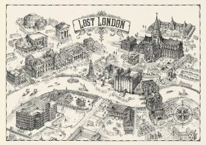
Brutalist London Map

For fans all all things concrete comes this map of London’s most famous Brutalist buildings. Created by Blue Crow Media (see also their craft beer and cycling maps, it is the first in a new series of map-based guides to London architecture, focusing on the modern 1950s/60s “raw” concrete-heavy designs by Le Corbusier and others […]

Continue reading »

Bomb Damage Maps 1939-1945

Several years ago, we featured some striking maps from a small exhibition at the London Metropolitan Archive. Each map was a detailed plan of a small part of London, the basemap being from 1916, with individual houses clearly shown. Many houses were just shown in white, but a number were coloured in various colours – […]

Continue reading »

Generalising OS MasterMap Buildings

The purpose of map generalisation is to represent spatial data in a way that makes it possible to effectively view the data at scales smaller than that for which it was originally intended. In the case of the Ordnance Survey’s MasterMap product you have data at an incredibly fine level of spatial resolution, which is […]

Continue reading »