Skip to content

The CASA Blog Network

The latest outputs from researchers, alumni and friends at the UCL Centre for Advanced Spatial Analysis (CASA).

    The CASA Blog Network

    Category: Infographics

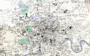
    Illustrations of Chartography

    Posted on Monday 23 January 2017 by James Cheshire

    I discovered this on ebay last week and had to buy it. Entitled “Illustrations in Chartography” it shows a series of different cartographic (or chartographic?) techniques used in the “School Atlas of Physical Geography” by Alex K Johnston. You can see the full book here. It’s too good not to share.

    Continue reading »
    Cartography, Featured Maps, Infographics, Slideshow, victorian, visualisation

    London: The Information Capital

    Posted on Tuesday 14 October 2014 by James Cheshire

    TheInformationCapital_cover_500px

    London has been home to many great cartographers and ha […]

    Continue reading »
    Book, Events, Infographics, information capital, james cheshire, london, oliver uberti, visualisation

    London: The Information Capital

    Posted on Tuesday 30 September 2014 by James Cheshire

    I am pleased announce that London: The Information Capi […]

    Continue reading »
    Book, Featured Maps, Infographics, london, london the information capital, Maps, Slideshow, visualisation

    Vignelli’s Map of the New York Subway

    Posted on Tuesday 26 August 2014 by Oliver O’Brien

    Mapping London is just back from a holiday in New York […]

    Continue reading »
    design, diagram, Infographics, metro, subway, transit, tube, vignelli

    Simplifying London’s Network – “Mappi Lundi”, A Hand Drawn Map

    Posted on Wednesday 24 July 2013 by Oliver O’Brien

    Mappa Lundi is a hand-drawn map of central London which […]

    Continue reading »
    colour, grid, hand drawn, hand drawn map, Infographics, network, paper, squares, streets

    The Tube Map: A tool for promoting social equality?

    Posted on Friday 12 October 2012 by James Cheshire

    tube_life

    Most government statistics are mapped according to offi […]

    Continue reading »
    data, Demographics, deprivation, equality, Infographics, Poverty, tube map, tube map life expectancy

    Olympic Venues as an Infographic Map

    Posted on Wednesday 25 July 2012 by Oliver O’Brien

    Thanks to the Chairman of CASA, Prof Michael Batty, for […]

    Continue reading »
    Infographics

    Recce

    Posted on Tuesday 17 July 2012 by Oliver O’Brien

    recce0

    Recce is an iPhone app which locates you on a map and s […]

    Continue reading »
    Infographics, visualisation

    A Week in the Life of the Underground (& Overground & DLR)

    Posted on Friday 4 May 2012 by James Cheshire

    week_in_life_zoom

    Perhaps inspired by Joy Division’s Unknown Pleasu […]

    Continue reading »
    CASA, dlr, Infographics, overground, TFL, tube, Week in the life

    Tweets vs Flickr Photos – Eric Fischer’s City Maps

    Posted on Wednesday 29 February 2012 by Oliver O’Brien

    Eric Fischer produced this interesting data map of Lond […]

    Continue reading »
    Infographics, visualisation

    London: A Year in Maps

    Posted on Monday 12 December 2011 by Oliver O’Brien

    london_year_in_maps

    Mapping London editors James and Ollie look back at som […]

    Continue reading »
    2011, data, Demographics, Events, Infographics, london, london year in maps, Maps, tube, visualisation

    UCL Hand Drawn Map of London

    Posted on Monday 5 December 2011 by James Cheshire

    ucl_map1

    Step aside Stephen Walter, over 270 UCL students (and s […]

    Continue reading »
    crowd source, hand drawn map, Infographics, london, UCL, visualisation

    Telecoms Clutter Map

    Posted on Sunday 12 June 2011 by Oliver O’Brien

    This map of mobile phone signal strength, produced by t […]

    Continue reading »
    Infographics

    Typographic London

    Posted on Friday 18 March 2011 by James Cheshire

    Some of the most popular posts on spatialanalysis are about typographic maps. I thought it would be cool to put together some of my favourite’s for London. Click on each…

    Continue reading »
    Infographics, london, typographic, typographic map, visualisation

    John Snow’s Cholera Map

    Posted on Wednesday 9 March 2011 by James Cheshire

    Embedded below is a high resolution version of John Snow’s 1854 map of the Broad Street (now Broadwick Street) cholera outbreak. Widely cited as the one of the first (and…

    Continue reading »
    1854, Broad Street, Cholera, Demographics, epidemiology, Infographics, John Snow

    CASA Website

    Our main website

    Contributors

    • Networking City Research blog on urban environment and citizen movements in complex networks
    • @emergentcity The personal blog-space of Gareth Simons -> architect | urbanist interested in performative simulation at the urban scale; space and flows as computational processes; information entropy & irreversibility; and the ‘edge of chaos’. Views are my own.
    • A Science of Cities complexcity
    • Adam Dennett
    • Alex Singleton
    • BDTK Blog Just another WordPress site
    • blog – ENFOLDing Global Dynamics and Complex Systems
    • CEDE Creating and Exploring Digital Empathy
    • CityGeographics: urban form, dynamics and sustainability Urban visualisation and spatial analysis research blog by Duncan A Smith
    • Crowd Simulation
    • Data-driven economics Why economics should be about observing and understanding the economy, duh.
    • DataShine Blog DataShine is an output of the ESRC BODMAS project which ran from 2013-2015 at UCL. To cite the project or websites, please use: Oliver O’Brien & James Cheshire (2016) Interactive mapping for large, open demographic data sets using familiar geographical fe
    • Digital Urban Data, Cities, IoT and Making Things
    • en-topia Urban Planning and the future of the city
    • GENeSIS Digital Social Research
    • George MacKerron: code blog GIS, software development, and other snippets
    • GIS + AR (Augmented Reality)
    • GIS and Agent-Based Modeling This is a research site focused around my interests in Geographical Information Science (GIS) and Agent-Based Modeling (ABM).
    • heartcode Coding “hard”, with the heart… :-)
    • James Cheshire Geography & Cartography
    • jpg4.us – little caprice dp' Search ,Fujian Shipbuilding Trading Co. Ltd. Shipbuilding in China
    • Mapping London Highlighting the best London maps.
    • mechanicity.info An ERC Advanced Grant
    • Output Area Classification User Group – OAC Open and Free Geodemographics
    • Pablo Mateos Associate Professor
    • Paul Longley Professor of Geographic Information Science, University College London
    • Placetique People, Data, Place
    • Po Ve Sham – Muki Haklay's personal blog GIScience, Citizen Science & Environmental Information
    • Population Geography promoting population geography, supporting population geographers
    • Python – Hannah Fry Dr. of fluid dynamics, researcher of complexity theory and all round bad-ass.
    • Quaestio research: questioning, inquiring, seeking, searching and scrutinising
    • QuanTile Quantitative Teaching, Research and Outreach in Geography
    • Quantitative Methods Research Group (QMRG) – Royal Geographical Society with IBG
    • Simone Caschili UCL QASER Lab & CASA Research Associate, University College London
    • Simulacra Showcasing land use transport modelling, urban complexity and sustainability research from the Centre for Advanced Spatial Analysis, University College London
    • Smart Cities Mainly Based on my Lectures on Models, Complexity, and Smart Cities at ASU, CUHK, CUSP at NYU, Ritsumeikan, SUFE-Shanghai, Tel Aviv, and UCL, with blogging odds and ends thrown in for good measure
    • Snakes on a brain Attempting scientific and mathematical programming in Python.
    • Sociable Physics Because “social physicist” is not an oxymoron.
    • Spatial Analysis | Scoop.it All the new curated posts for the topic: Spatial Analysis
    • Steven Gray
    • Stories by Max Nathan on Medium Stories by Max Nathan on Medium
    • Suprageography Thoughts on urban mobility services, digital cartography and data visualisation.
    • Talisman Geospatial Data Analysis and Simulation
    • topometries Land-use dynamics, pedestrian behaviour and transport simulation, multi-agent systems and spatial morphology
    • Urbagram An Instiki wiki
    • UrbanMovements Flows, Behaviour and Networks in the City
    • UrbanTick
    • Volunteered Geographic Information A Geography/GIS blog by Daniel J Lewis
    Powered by WordPress and Momentous.