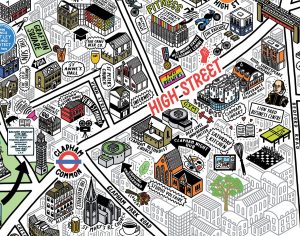
Treasures of Hackney

This is a map of Hackney Borough, from the perspective of its old, wealthy houses, and the discovered and undiscovered treasures buried under them. It was drawn by Adam Dant, and is one of the maps featured in his book “Maps of London & Beyond” which was published last month and we reviewed. The map […]

Continue reading »

Maps of London & Beyond

Adam Dant has, for a long time, been sketching lovely maps of London history, culture and phenomena, often focusing in particular on S the historic East End. Now, Batsford, an imprint of Pavilion Books, has produced this book, collating Dant’s existing wonderful maps (and debuting some new ones) in single place and adding background information. […]

Continue reading »

East End Independents

This hand-sketched map has been produced by Adam Dant and Herb Lester, for the East End Trades Guild, to promote over 200 small businesses based in east and north-east London. Over a hundred of these are independent shops, cafes and restaurants to visit. The map is presented with an unusual projection, focusing on Columbia Road […]

Continue reading »

Animated Acton

acton-w3-map

Here’s a nice hand-drawn map created by graphic designer John Hathaway, of his neighborhood, Acton in west London, along with some local landmarks. We like the good, crisp cartography and the detail, particularly the individual trees and the Robin Reliant! Event better, here’s a speeded-up video of the creation of the map itself: Sent by […]

Continue reading »

Dear Data – My London

This is one of the many data visualisation and design postcards that Stefanie Posavec and Georgia Lupi sent each other of the course of a year. It’s a personal map of Stefanie’s London history – where she lived, studied and worked, her main commute and other routes. Everyone living in London will build up a […]

Continue reading »

Argotopolis

tagfinearts_argotopolis_detail

Argotopolis is a map of London slang, created by Adam Dant (cartographer) and Jonathon Green (lexicographer). At first glance it looks like an ornate tree, look more closely and you’ll realise it is indeed a map, with Farringdon Road acting as the trunk of an “Old Oak” (aka the “Big Smoke”, aka London) – and […]

Continue reading »