What does science look like? This might evoke black and white images of the cities and sixties showing male scientists in white lab coats bent over a table where some assistant has layed out various tools and models. Materials are steel, chrome, glass and colourful plastic. Shown in the background is probably a black board with some formulas and equations written on.
But what does science really look like, today? In a new Lars Müller Publishers publication Andri Pol shows the reader some inside glimpse of one of the biggest scientific research labs in the world. In Inside CERN: European Organization for Nuclear Research he has been documenting work and live in and around CERN, the European Organisation for Nuclear Research.
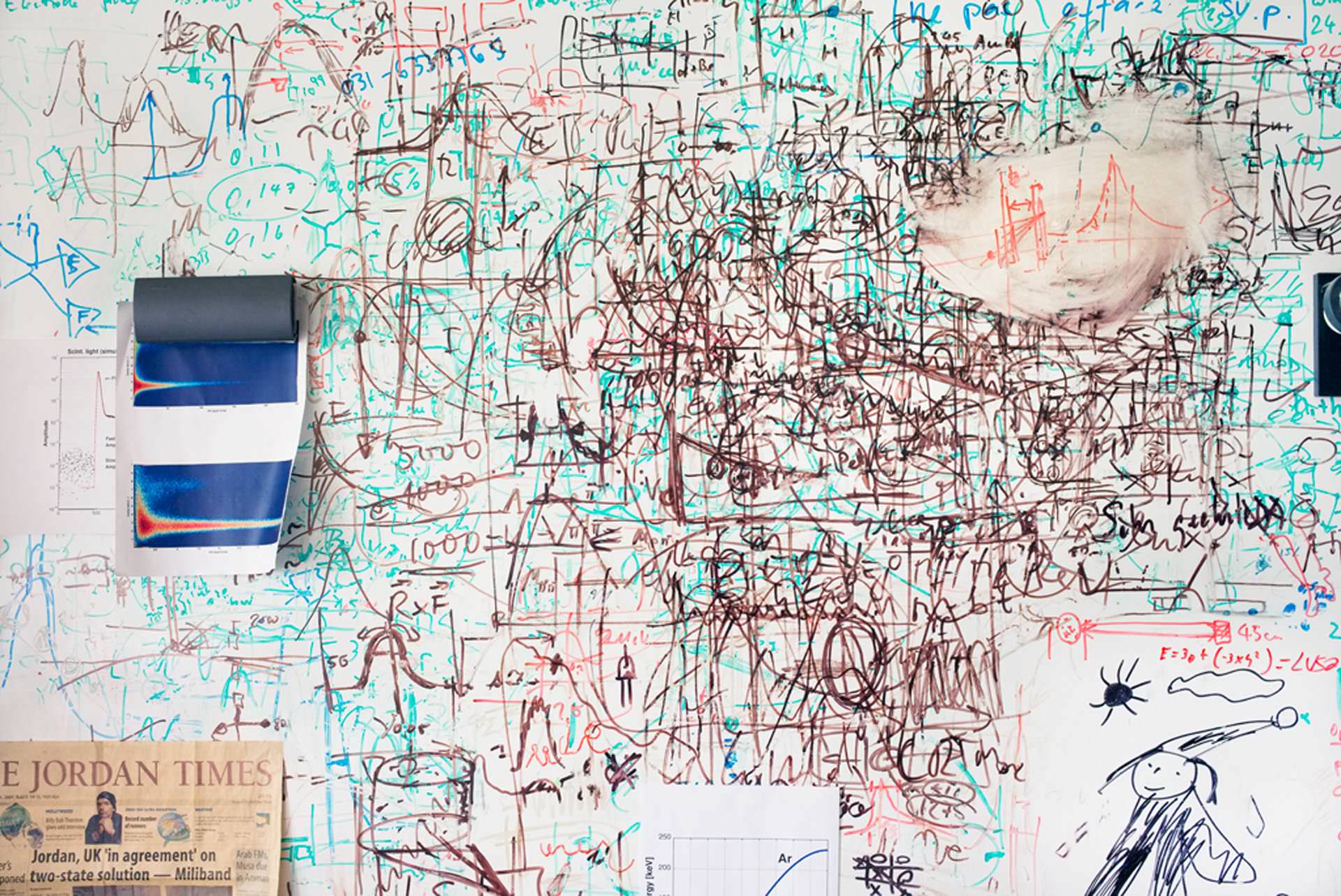 Image taken from uncubemagazine / ‘layered equations’ p.233.
Andri Pol is a Swiss freelance photographer with a specific focus on the everyday. This is also how he portraits the places, labs, offices, scientists and atmospheres at CERN, with great curiosity and respect.
There are no pretty pictures to be found in this documentation and there are no glorious moments. Its all about the effort, the struggle and the dedication. Flipping though the pages only unveils a great range of colours and oddly chosen angles or frames. The book does not work that way. The photographs are actually rather complex compositions with a lot of depth each with not just one but often a number of aspects.
Whilst there is a lot of equipment and machines visible there is an emphasis on the people who are involved at CERN in some way. Being this the scientists, indeed sometimes in white overcoats and blue shoe protectors, technical staff or students. People from all over the world come together at CERN working in teams. This is often shown, science is discussion and exchange.
The documentation portraits also the atmosphere at CERN. Beside the highly technical installations there is very little shiny and new infrastructure. In fact most of the facilities seem to be rather pragmatic and often improvised. It is clear the focus is somewhere else. This place is not about design and style, but about customablilty, flexibility and improvisation. That does not mean that self expression is absence. On the contrary the numerous portraits of individualised desks, doors, books and computers themselves tell a story.
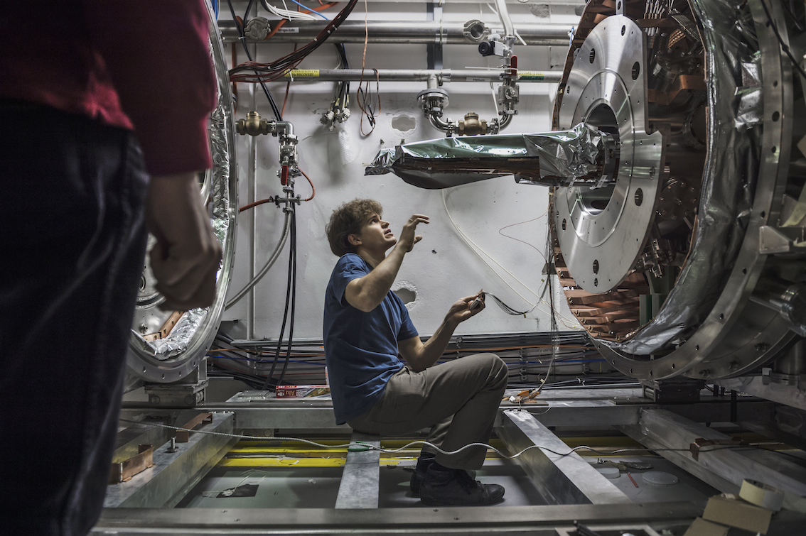 Image taken from klatmagazine / ‘calibrate’ p.243.
Only on the last few pages the photographs stet to show some of the machinery of the actual Large Hadron Collider (LHC), photographs that look similar to what is usually circulated in the meadia. By that point the reader is already so deep immersed in the atmosphere at CERN that is seems to be most natural thing to walk past this monster of infrastructure that doesn’t even fit on a photograph. In many ways all the other photographs tell a much more telling tale of the LHC than the tons of steel, cable and concrete.
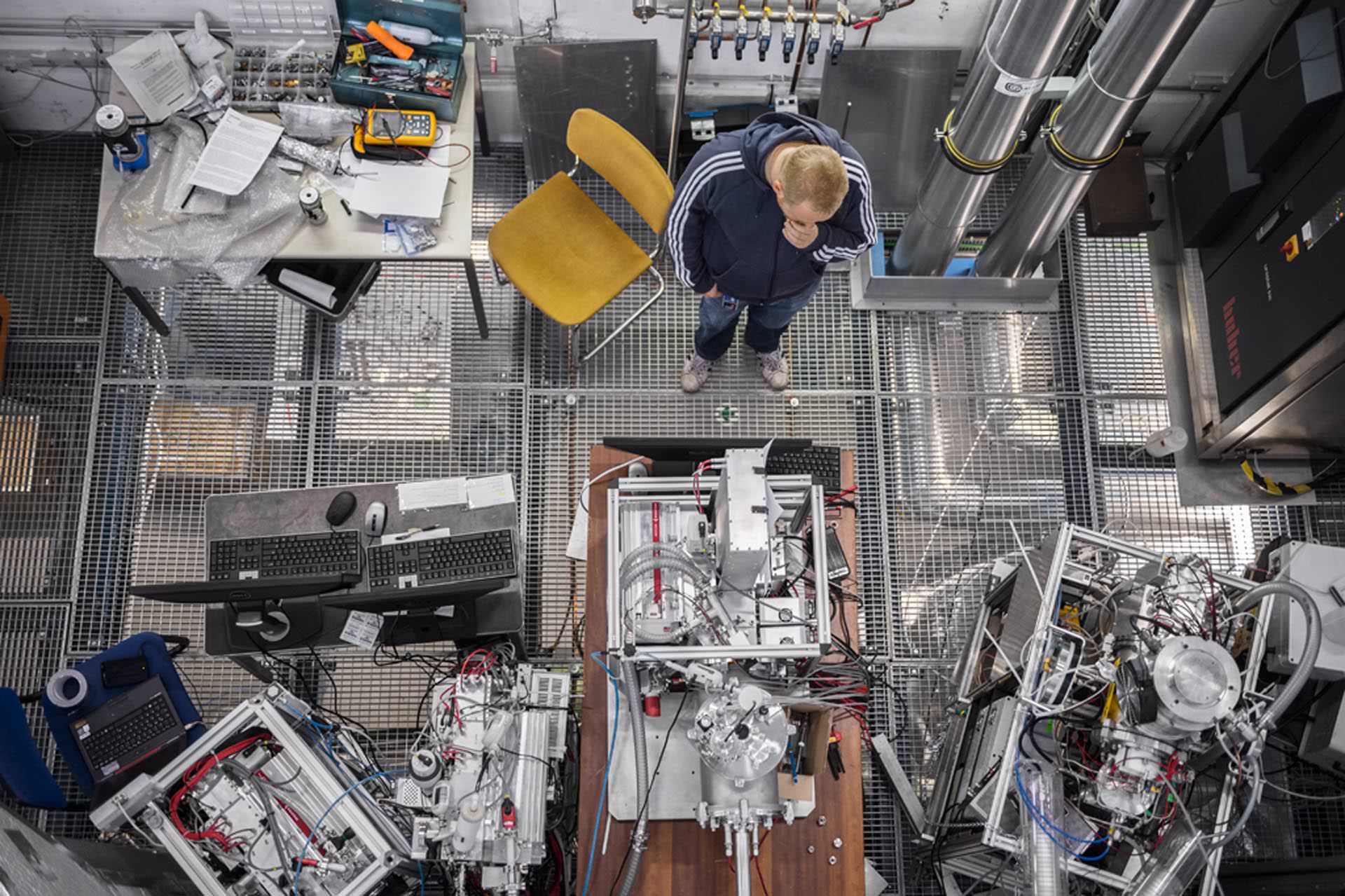 Image taken from uncubemagazine / ‘thinking’ p.249.
This being a Lars Müller Publisher publication it does not come as a surprise that this is a very beautifully made book. A lot of care has gone into the design of the book and the selection of the photographs. Even though it is mainly a picture book a real narrative is being told here something that captivates the reader. This book certainly tells a very different story about science today. It is of course documenting science in a unique biotope of research and collaboration creating a special place between Switzerland and France. But what it shows is the fascination and dedication of the individuals working in this field and manages to transport this.
If this is not quite yet enough. Google has collaborated with cern and it features on Street View. Try this link to go on a virtual walk around CERN and the LHC.
 Image taken from amazon.com / Book cover. More details also available on the book website at insidecern.com.
Pol, A., 2011. Inside CERN: European Organization for Nuclear Research. Lars Muller Publishers, Zürich.
Continue reading »