The Covent Gardener

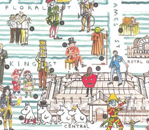
In celebration of the Christmas lights being switched on in Covent Garden this evening, we feature this lovely map of the precinct, which has been drawn by artist Adam Dant, for The Covent Gardener, a periodical that focuses on the landmarks, shops and residents and characters of London’s famous and bustling shopping and tourism heart, […]

Continue reading »

Treasures of Hackney

This is a map of Hackney Borough, from the perspective of its old, wealthy houses, and the discovered and undiscovered treasures buried under them. It was drawn by Adam Dant, and is one of the maps featured in his book “Maps of London & Beyond” which was published last month and we reviewed. The map […]

Continue reading »

Tranquil Pavement

Tranquil Pavement is an online map recently launched by the Tranquil City project based in London, in association with the Outlandish Cooperative and funded by Organicity. It aims to highlight tranquil places to visit, if the hustle and bustle of city life gets too much, by plotting “crowdsourced “locations – referenced in an Instagram feed […]

Continue reading »

London National Park City Map

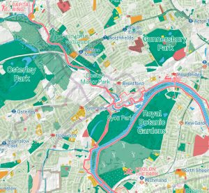
Urban Good, a new community interest company created by Charlie Peel, have this month published the first edition of their London National Park City Map. This huge, folded paper map covering the whole of London, was created through a crowdfunding campaign, and is available from Urban Good’s web store for just a payment of a […]

Continue reading »

London’s Street Trees

Following a data release of Southwark’s publically maintained trees a couple of years back, the Greater London Authority recently published a map which shows street trees (trees along roads and public paths, and trees in public open spaces, such as small parks and other minor green areas). Each borough has its own tree database and […]

Continue reading »