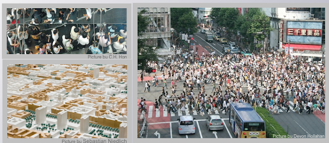
Call for papers: Intelligent Agents in Urban Simulations and Smart Cities

Readers of the blog might be interested in the “Intelligent Agents in Urban Simulations and Smart Cities” workshop at the  ECAI-2012 Conference in Montpellier, France, August 27 or 28, 2012.

To quote from the call for papers:

In this workshop, we intend to address specific methodological and technological issues raised by the deployment of agents in rich environments such as virtual cities. We will welcome contributions tackling issues related to reactive agents, cognitive architectures, the capacity to scale up to handle thousands or hundreds of thousands of agents, the ability to simulate realistic group behaviors which might be judged non rational, etc., all in the context of urban agents. We will also welcome contributions showcasing original applications of agent and multi-agent technologies within urban simulations, be it for design, planning, education, training, or entertainment. 

Workshop Chairs: 

  • Vincent Corruble (contact), Université Pierre et Marie Curie (Paris 6), France 
  • Fabio Carrera, Worcester Polytechnic Institute (WPI), USA 
  • Stephen Guerin, Santa Fe Complex, USA 

Important Dates: 

  • *6 June 2012*: Workshop paper submission deadline 
  • 28 June 2012: Notifications to authors (subject to modification) 
  • 13 July 2012: Submissions of camera-ready copies of selected papers 
  • 27 or 28 August 2012: Workshop date 

Submission information: 

Continue reading »

Modelling Movement in the City: The Influence of Individuals

‘Modelling Movement in the City: The Influence of Individuals’ was the title of a talk I gave at the AGILE conference in Avignon, France last week. For the conference I actually initially prepared a poster that never ended up seeing the light of d…
Read more

Continue reading »

Natural Disasters and Crowdsourcing: Haiti

Natural disasters such as earthquakes and tsunamis occur all over the world, altering the physical landscape and often severely disrupting people’s daily lives. Recently researchers’ attention has focused on using crowds of volunteers to help map the infrastructure and devastation caused by natural disasters, such as those in Haiti and Pakistan. For example, in the movie below shows the response to the earthquake by the OpenStreetMap community within 12 hours of the earthquake. The white flashes indicate edits to the map (often by tracing satellite/aerial photography).
While this data is extremely useful, as it is allows us to assess damage and thus aid the distribution of relief, but it tells us little about how the people in such areas will react to the devastation, the supply of food, or the reconstruction. To address this, we are exploring how agent-based modeling can be used to explore peoples reactions. To do this we have created a prototype spatially explicit agent-based model, created using crowdsourced geographic information and other sources of publicly available data, which can be used to study the aftermath of a catastrophic event. The specific case modeled here is the Haiti earthquake of January 2010. Crowdsourced data is used to build the initial populations of people affected by the event, to construct their environment, and to set their needs based on the damage to buildings. 

The idea behind the model is to explore how people react to the distribution of aid, as well as how rumors propagating through the population and crowding around aid distribution points might lead to food riots and similar social phenomena. Such a model could potentially provide a link between socio-cultural information of the people affected and relevant humanitarian relief organizations.

<p><p>sssss</p></p>

The animation above shows one simulation run where there is the spread of  information and agent movement (red dots) around one center (blue dot). While the chart below shows how over time the density of agents around the food station increases over time.

The idea behind such a model is one can take crowdsourced information and fuse it into an agent-based model and see how people will react to the distribution of food centers. For example, the movie below shows how agents find out about four (hypothetical) different food centers and decide whether or not to go to them in a 6 by 8km area of Port-au-Prince.

Spread of information and agent movement (red dots) in a 6 by 8km area of Port-au-Prince.
More details about this model to come……
Continue reading »

Natural Disasters and Crowdsourcing: Haiti

Natural disasters such as earthquakes and tsunamis occur all over the world, altering the physical landscape and often severely disrupting people’s daily lives. Recently researchers’ attention has focused on using crowds of volunteers to help map the infrastructure and devastation caused by natural disasters, such as those in Haiti and Pakistan. For example, in the movie below shows the response to the earthquake by the OpenStreetMap community within 12 hours of the earthquake. The white flashes indicate edits to the map (often by tracing satellite/aerial photography).
While this data is extremely useful, as it is allows us to assess damage and thus aid the distribution of relief, but it tells us little about how the people in such areas will react to the devastation, the supply of food, or the reconstruction. To address this, we are exploring how agent-based modeling can be used to explore peoples reactions. To do this we have created a prototype spatially explicit agent-based model, created using crowdsourced geographic information and other sources of publicly available data, which can be used to study the aftermath of a catastrophic event. The specific case modeled here is the Haiti earthquake of January 2010. Crowdsourced data is used to build the initial populations of people affected by the event, to construct their environment, and to set their needs based on the damage to buildings. 

The idea behind the model is to explore how people react to the distribution of aid, as well as how rumors propagating through the population and crowding around aid distribution points might lead to food riots and similar social phenomena. Such a model could potentially provide a link between socio-cultural information of the people affected and relevant humanitarian relief organizations.

<p><p>sssss</p></p>

The animation above shows one simulation run where there is the spread of  information and agent movement (red dots) around one center (blue dot). While the chart below shows how over time the density of agents around the food station increases over time.

The idea behind such a model is one can take crowdsourced information and fuse it into an agent-based model and see how people will react to the distribution of food centers. For example, the movie below shows how agents find out about four (hypothetical) different food centers and decide whether or not to go to them in a 6 by 8km area of Port-au-Prince.

Spread of information and agent movement (red dots) in a 6 by 8km area of Port-au-Prince.
More details about this model to come……
Continue reading »

Distributed MASON

Last week, the Center for Social Complexity at GMU, hosted Prof. Vittorio Scarano and Carmine Spagnuolo from the ISISLab of the Università degli Studi di Salerno who have been working on a distributed version of MASON (DMason). The idea is that one can create an agent-based model in MASON and then use the framework to easily distribute it over many machines. The movie below shows an example of what can be done. More information can be found here.

However, if you don’t use MASON, you might also be interested in Repast for High Performance Computing

Continue reading »

Data Space: Agent Based Models, SketchUp, Visualisation, ArcGIS and Lumion

Over the past few weeks we have been exploring exploring new methods and techniques for visualising data. Developed as part our Masters course in Advanced Spatial Analysis and Visualisation we are now looking into issues of scale, realtime renderi…

Continue reading »
1 3 4 5 6