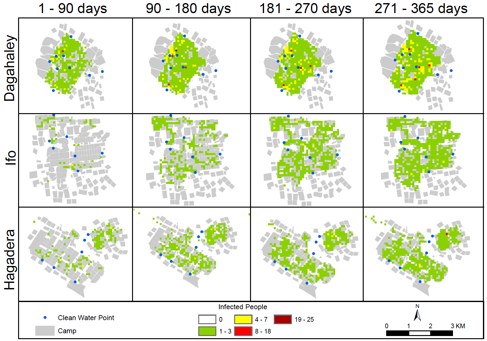
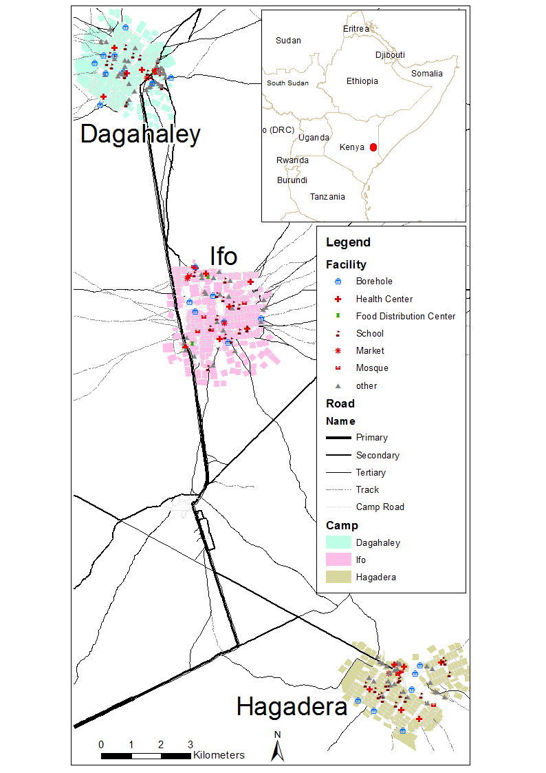
New Directions In Geospatial Simulation
The geospatial simulation community has enjoyed steady growth over the past decade as novel and advanced forms of agent-based and cellular automata modeling continue to facilitate the exploration of complex geographic problems facing the world today. It is now an opportune time to consider the future direction of this community and explore ways to leverage geospatial simulation in professional arenas. The aim of these sessions is to bring together researchers utilizing agent-based and cellular automata techniques and associated methodologies to discuss new directions in geospatial simulation. We invite papers that fall into one of the following four categories:
- Graduate student geospatial simulation research
- Methodological advances of agent-based or cellular automata modeling
- New application frontiers in geospatial simulation
- Approaches for evaluating the credibility of geospatial simulation models
Student papers will be presented in an interactive short paper session with presentations no longer than five minutes and no more than ten slides. Following presentations, students will form a panel that will address questions from the audience as directed by the session moderator. Student presentations will be judged as a part of a Best Student Paper award, the winner of which will receive an award of $500.
All other papers will be placed in one of the following three sessions: (1) Methodological Advances, (2) Novel Applications, or (3) Model Credibility. Each session will be comprised of four speakers followed by a twenty-minute discussion on the session topic.
Please e-mail the abstract and key words with your expression of intent to
Chris Bone by October 28, 2014. Please make sure that your abstract conforms to the AAG guidelines in relation to title, word limit and key words and as specified at
http://www.aag.org/cs/annualmeeting/call_for_papers. An abstract should be no more than 250 words that describe the presentation’s purpose, methods, and conclusions as well as to include keywords. Full submissions will be given priority over submissions with just a paper title.
ORGANIZERS:
Chris Bone, Department of Geography, University of Oregon
Andrew Crooks, Department of Computational Social Science, George Mason University
TIMELINE:
October 14th, 2014: Second call for papers
October 28th, 2014: Abstract submission and expression of intent to session organizers. E-mail
Chris Bone by this date if you are interested in being in this session. Please submit an abstract and key words with your expression of intent. Full submissions will be given priority over submissions with just a paper title.
October 31st, 2014: Session finalization. Session organizers determine session order and content and notify authors.
November 3rd, 2014: Final abstract submission to AAG, via
www.aag.org. All participants must register individually via this site. Upon registration you will be given a participant number (PIN). Send the PIN and a copy of your final abstract to
Chris Bone. Neither the organizers nor the AAG will edit the abstracts.
November 5th, 2014: AAG registration deadline. Sessions submitted to AAG for approval.
April 21-25, 2014: AAG meeting, Chicago, Illinois, USA.
Continue reading »