Come Work with Us: 2 Postdocs in Urban Simulation
The George Mason University Department of Geography and Geoinformation Science within the College of Science, has an immediate opening for two postdoctoral fellows (up to 2-years), subject to budgetary approval. These positions will be part of the “Urban simulation” project team conducting research as part of the DARPA’s “Ground Truth” program, a network of DARPA-funded teams across the USA. The GMU team is directed by Andreas Züfle, Dieter Pfoser, and Andrew Crooks and supported by Carola Wenk at Tulane University. George Mason University has a strong institutional commitment to the achievement of excellence and diversity among its faculty and staff, and strongly encourages candidates to apply who will enrich Mason’s academic and culturally inclusive environment.
Postdoc 1
Responsibilities:
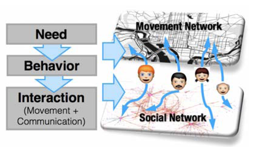
The primary job responsibilities of this position consist of the design, development and refinement of an agent-based simulation framework for urban areas. Using the existing Multiagent Simulation Toolkit (MASON) platform (written in Java), new agent logic will have to be implemented, thus creating agents that use socially plausible rules for mobility and interaction with other agents. A main goal is to create computationally efficient agent logic, thus allowing millions of agents to make decisions, find shortest paths between locations, and interact with their simulated world at the same time. For this purpose, implemented algorithms will need to be highly parallelizable, thus allowing to scale simulation via distribution among computing clusters located at GMU and Tulane. The successful candidate will also supervise graduate-level research assistants, collaborate with fellow scholars, and promote the department’s accomplishments through publications, presentations, and other public events.
The primary job responsibilities of this position consist of the design, development and refinement of an agent-based simulation framework for urban areas. Using the existing Multiagent Simulation Toolkit (MASON) platform (written in Java), new agent logic will have to be implemented, thus creating agents that use socially plausible rules for mobility and interaction with other agents. A main goal is to create computationally efficient agent logic, thus allowing millions of agents to make decisions, find shortest paths between locations, and interact with their simulated world at the same time. For this purpose, implemented algorithms will need to be highly parallelizable, thus allowing to scale simulation via distribution among computing clusters located at GMU and Tulane. The successful candidate will also supervise graduate-level research assistants, collaborate with fellow scholars, and promote the department’s accomplishments through publications, presentations, and other public events.
Required Qualifications:
- Ph.D. in computer science, data science, or closely related field;
- Strong programming skills in Java;
- Excellent written communication skills demonstrated by prior publications;
- A track record that demonstrates the ability to work well with interdisciplinary research teams.
Preferred Qualifications:
- Solid knowledge of graph algorithms;
- Experience with Agent-Based Modeling and social science simulation;
- Experience in design and implementation of software systems.
More Information: https://jobs.gmu.edu/postings/42107
Postdoc 2
Responsibilities:
The primary job responsibilities of this position will be the design of an agent-based model based on the first principles underlying human needs, social interactions, and mobility to define socially plausible causalities. This model will contribute towards the design, development and refinement of an agent-based simulation framework for urban areas. Using the existing Multiagent Simulation Toolkit (MASON) platform (written in Java), new agent logic will have to be implemented, thus creating agents that use socially plausible rules for mobility and interaction with other agents. The successful candidate will also supervise graduate-level research assistants, collaborate with fellow scholars, and promote the department’s accomplishments through publications, presentations, and other public events.
Required Qualifications:
- Ph.D. in computer science, data science, or closely related field;
- Experience with Agent-Based Modeling and social science simulation;
- Excellent written communication skills demonstrated by prior publications;
- A track record that demonstrates the ability to work well with interdisciplinary research teams.
Preferred Qualifications:
- Strong programming skills in Java;
More Information: https://jobs.gmu.edu/postings/42109
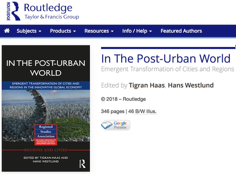 This new book edited by Tigran Haas and Hans Westlund from KTH is a collection of interesting and somewhat oblique essays on the urban world we have entered. Lot of people you know writing here. Ed Glaeser, Richard Florida, Patrick …
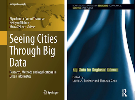 Two new volumes in big data, cities and regions, with a strong spatial focus. The first Seeing Cities Through Big Data: Research, Methods and Applications in Urban Informatics’ is edited by Piyushimita (Vonu) Thakuriah, Nebiyou Tilahun, and Moira Zellner and published …

 This article took 5 years in the making. We – Urskar, Jon, Ed, and myself – thought that it was a great project to see what was big data on taxi flows in central London in 1962 could be compared …


 To celebrate the 50th anniversary of Regional Studies, the Book Reviews section of the journal has published a series of reviews of books originally published decades ago, and whose influence has grown sufficiently that they are considered classics and milestones …