Measuring Comparative Public Transport Accessibility for GB Cities

While Greater London has a comprehensive transit network, this is not a fair representation of UK cities where underinvestment and privatisation has seen many bus, metro and rail networks stagnate in recent decades, falling well behind European and Asian peers. Improving public transport is an important aspect of addressing the UK’s high regional inequality and … Continue reading Measuring Comparative Public Transport Accessibility for GB Cities

Continue reading »
Can the Green Belt be Developed Sustainably to Ease London’s Housing Crisis?

The housing crisis in London has become increasingly severe in the last decade with much higher prices, rents, and largely static incomes, while housing development volumes have remained consistently below targets. Green Belt reform is often cited as a solution to boost development, though this has been off the agenda during the last 13 years … Continue reading Can the Green Belt be Developed Sustainably to Ease London’s Housing Crisis?

Continue reading »

World Population Density Map Update with GHSL 2023

The European Union JRC recently released a new 2023 update of the Global Human Settlement Layer (GHSL) data. This update has greatly improved the GHSL data, with a 10m scale built-up area dataset of the entire globe which has been used to create a 100m scale global population density layer. The level of detail for … Continue reading World Population Density Map Update with GHSL 2023

Continue reading »

Post-Pandemic Changes in Travel Behaviour: Evidence from the National Travel Survey England 2021

The pandemic and subsequent lockdowns have seen the largest and most sustained disruptions to travel behaviour in most of our lifetimes. Stay-at-home policies have fuelled an explosion in remote working, and wider online substitution of other activities such as shopping and socialising. In sustainability terms, the pandemic has severely hit public transport and incentivised car … Continue reading Post-Pandemic Changes in Travel Behaviour: Evidence from the National Travel Survey England 2021

Continue reading »

A Compact City for the Wealthy? Continuing Inner London Gentrification and Impacts on Accessibility Inequalities

We have a new open access paper out in the Journal of Transport Geography- “A compact city for the wealthy? Employment accessibility inequalities between occupational classes in the London metropolitan region 2011“. The paper explores how the increasingly affluent nature of Inner London has improved sustainable travel opportunities for more affluent professional and management classes, … Continue reading A Compact City for the Wealthy? Continuing Inner London Gentrification and Impacts on Accessibility Inequalities

Continue reading »

HERE Urban Mobility Index

The HERE Urban Mobility Index profiles 30 cities around the world, looking at how connected, sustainable, affordable and innovative they are, relating to urban mobility – the options that people have to move around the city area. London is one of the cities and scores first place for its public transport efficiency and low emission […]

Continue reading »

Global Prospects for a Post-Car World

Earlier this year I worked on some charts and maps for a Greenpeace report authored by sustainable transport academic Robin Hickman, exploring the impacts of automobile dependence and the prospects for a post-car world. The report is online here. The much debated phenomenon of ‘peak-car’ can be observed in many countries in the global north, … Continue reading Global Prospects for a Post-Car World

Continue reading »

Traffic Counts

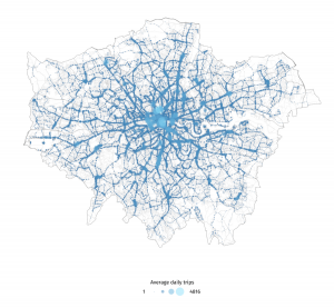
My latest London data visualisation crunches an interesting dataset from the Department of Transport. The data is available across England, although I’ve chosen London in particular because of its more interesting (i.e. not just car dominated) traffic mix. I’ve also focused on just the data for 8am to 9am, to examine the height of the […]

Continue reading »

The Potential of Volunteered Geographic Information (VGI) in Future Transport Systems

An aspect of collaborative projects is that they start slowly, and as they become effective and productive, they reached their end! The COST Energic (European Network for Research into Geographic Information Crowdsourcing) led to many useful activities, with some of them leading to academic papers. From COST Energic, we’ve got the European Handbook on Crowdsourced Geographic … Continue reading The Potential of Volunteered Geographic Information (VGI) in Future Transport Systems

Continue reading »

Animating Global Innovation Diffusion- Public Transport

We know that knowledge networks and intensive competition within cities boosts innovation. There are also further scales to this dynamic. The networks and competition between cities at regional and global scales promotes the adoption of new ideas- as cities buy, borrow and adapt ideas from their competitors. It’s this latter global dynamic that we’re exploring … Continue reading

Continue reading »

Copenhagen and Hong Kong: Mapping Global Leaders in Green Transport

Cities that achieve social and economic success without high car use generally have three things in common: high densities, good urban design, and successful planning frameworks that integrate land-use with public transport, walking and cycling networks. I’ve been working on an LSE Cities project that investigated two leading global cities in green transport- Copenhagen and … Continue reading

Continue reading »

Automobile 2.0: Electrification, Sharing and Self-Drive

  Despite the litany of sins levelled at the automobile- it’s woeful energy efficiency, harmful pollution, congestion, road casualties, damage to public space, contribution to obesity- we are still wedded to the car. In the UK the car accounts for over three quarters of trip miles. The flexibility, security and door-to-door convenience of automobile travel remains … Continue reading »

Continue reading »

Mapping City Flows as Blood

Blood is everywhere when it comes to describing cities. We have arterial roads, pulsing transport flows, and cities with different metabolisms. Thanks to great new datasets and visualisation software the analogy of cities with pulsing flows is being increasingly utilised for explanatory mapping. For example the work of UCL CASA’s Jon Reades above depicts the London Underground network …

Continue reading »
1 2