Latest Posts

High speed UK: Why HS2 must only be the start of a wider national high speed rail network – CityMetric


CityMetric

High speed UK: Why HS2 must only be the start of a wider national high speed rail network
CityMetric
HS2 is, to put it mildly, a divisive topic, with many compelling arguments on both sides of the debate. For UK cities, HS2 represents a mixed bag. That’s true, both in terms of the positives and negatives for individual cities; but also in that, as

and more »

Continue reading »

Symposium: Creating and Exploring Digital Empathy, 21 March at the RSA

The project CEDE is about researching empathy in digital environments, and prototyping devices and services that are designed to facilitate empathy between people. We are organising a one day Creating and Exploring Digital Empathy symposium on Monday 21 March at the Royal Society for the Arts in London, where the project […]

The post Symposium: Creating and Exploring Digital Empathy, 21 March at the RSA appeared first on CEDE.

Continue reading »

Call for abstracts – PopFest 2016: The 24th Annual Population Postgraduate Conference

Tweet  4th – 6th July 2016   University of Manchester   PopFest is an annual Population Studies conference for postgraduate students organised by fellow postgraduates. It provides an excellent opportunity to bring together researchers from various Social Science disciplines such as Demography, Human Geography, Urban Planning, Sociology, Social Anthropology, Social Statistics, Politics and other related […]

Continue reading »

Policy Forum: Europe’s migration crisis? 22 March 2016, RGS-IBG

TweetEurope’s migration crisis? 21st Century Challenges: Policy Forum Tuesday 22 March 2016: 5.30pm – 7.30pm (with the opportunity to stay for dinner until 9.30pm) Join the Royal Geographical Society (with IBG) for a lively panel discussion (5.30pm – 7.30pm), with the opportunity to stay for dinner (7.30pm – 9.30pm) to explore the challenges and opportunities […]

Continue reading »

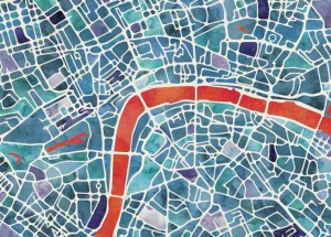
Graphic Watercolour Map

watercolour_extract

Here’s a lovely looking artistic map of London. Created by Ben Grib in a “watercolour” style and produced as a print on “natural” textured art paper with plenty of grain, the Graphic Watercolour Map shows the spaces between streets with a characteristic painted look, the tones varying from block to block. The remaining white space […]

Continue reading »

Forget HS2: Only radical education reform will rescue the Northern Powerhouse – City A.M.


City A.M.

Forget HS2: Only radical education reform will rescue the Northern Powerhouse
City A.M.
The author, Mike Batty, is an extremely distinguished professor in University College London’s Centre for Advanced Spatial Analysis. I work with Batty, so maybe this colours my view of his ideas. But despite many billions of pounds of public money

Continue reading »

Infrastructure, integration, and what Gabon can teach cities about planning for the future – CityMetric


CityMetric

Infrastructure, integration, and what Gabon can teach cities about planning for the future
CityMetric
Finally, our map of the week – which, I’ll be honest, we do no justice to whatsoever – is this magnificent piece of work by Duncan Smith of UCL’s Centre for Advanced spatial Analysis. It shows, at a glance, the growth of all the world’s major cities

Continue reading »

Sorry, but the Northern Powerhouse can’t cover the entire north – CityMetric


CityMetric

Sorry, but the Northern Powerhouse can’t cover the entire north
CityMetric
Finally, our map of the week – which, I’ll be honest, we do no justice to whatsoever – is this magnificent piece of work by Duncan Smith of UCL’s Centre for Advanced spatial Analysis. It shows, at a glance, the growth of all the world’s major cities

and more »

Continue reading »

New PhD Opportunity: Human Computer Interaction and Spatial Data Quality for Online Civic Engagement

We have a new scholarship opening at the Extreme Citizen Science group for a PhD student who will research in Human Computer Interaction and Spatial Data Quality for Online Civic Engagement. The studentship is linked and contextualised by the European Union H2020 funded project, WeGovNow! . This project will focus on the use of digital technologies for effectively … Continue reading New PhD Opportunity: Human Computer Interaction and Spatial Data Quality for Online Civic Engagement

Continue reading »

These interactive maps show North America’s Pacific Coast after the ice caps have melted – CityMetric


CityMetric

These interactive maps show North America’s Pacific Coast after the ice caps have melted
CityMetric
Finally, our map of the week – which, I’ll be honest, we do no justice to whatsoever – is this magnificent piece of work by Duncan Smith of UCL’s Centre for Advanced spatial Analysis. It shows, at a glance, the growth of all the world’s major cities

and more »

Continue reading »

Living Maps Review launched today

Living Maps review is a new online journal about maps, map making and thinking of mapping (I’m on the editorial board of the journal). As the launch email describes: “map making as a democratic medium for visual artists, writers, social  researchers and community activists. The journal has its roots in the highly successful series of … Continue reading Living Maps Review launched today

Continue reading »

named

named is a little website that I have recently co-written as part of an ongoing ESRC-funded project on UK surnames that is being conducted here at UCL Department of Geography. I put together the website and adapted for the UK some code on generating heatmaps showing regions of unusual popularity of a surname, that was … Continue reading named

Continue reading »

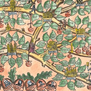
Argotopolis

tagfinearts_argotopolis_detail

Argotopolis is a map of London slang, created by Adam Dant (cartographer) and Jonathon Green (lexicographer). At first glance it looks like an ornate tree, look more closely and you’ll realise it is indeed a map, with Farringdon Road acting as the trunk of an “Old Oak” (aka the “Big Smoke”, aka London) – and […]

Continue reading »

New Paper- Online Interactive Mapping: Applications and Techniques for Socio-Economic Research

I have a new paper published in Computers Environment and Urban Systems- Online interactive thematic mapping: applications and techniques for socio-economic research. The paper reviews workflows for creating online thematic maps, and describes how several leading interactive mapping sites were created. The paper is open access so you can download the pdf for free. The paper…

Continue reading »

23 possible reasons why London’s Crossrail has just been renamed the Elizabeth Line – CityMetric


CityMetric

23 possible reasons why London’s Crossrail has just been renamed the Elizabeth Line
CityMetric
Because Queen Elizabeth II is the longest reigning queen regnant (one who reigns in her own right, rather than one who is just married to a king) in human history. Because on 9 September 2015, she surpassed her great great grandmother Queen Victoria to …

and more »

Continue reading »

ICA/Esri Cartographic Summit

I attended the Cartographic Summit which took place at the Esri campus in Redlands, California, earlier this week. Some notes from the week, which was co-organised by Esri and the ICA (International Cartographic Association). Here are some notes about the event. The attendee list included some key names in modern cartography, including Cynthia Brewer, creator … Continue reading ICA/Esri Cartographic Summit

Continue reading »

Call for Papers: GeoSocial: Social Media and GIScience

GeoSocial: Social Media and GIScience


A GIScience 2016 Workshop

September 27th, Montreal, Canada

This day-long workshop aims to serve as a platform to discuss and showcase the complex issues associated with the analysis of social media contributions in the context of GIScience.

Spanning spatial footprints, social networks, and sociocultural themes, such data can support a variety of applications, ranging from disaster response and environmental monitoring to health informatics and digital citizenship. Given their variations in accuracy, the complex patterns of participation, and the constantly increasing data volumes, analyzing such data in a meaningful, reliable, and timely manner is a substantial challenge. The objective of this workshop is to showcase on-going research in the GIScience community on the analysis of social media content and thus support the emergence of a cohesive research agenda in our community.

We invite submissions of short papers (1,500-2,000 words) that present research related to the workshop theme. Examples of topics of particular interest include:

  • Theoretical/conceptual issues in linking social media with GIScience.
  • Accuracy and reliability issues associated with the analysis of social media content.
  • Analysis of the spatial and spatiotemporal patterns of social networks.
  • Geocoding methods and engines for social media messages.
  • GeoSocial Analytic software and tool development.
  • Visualization of multi-thematic geosocial content.
  • Computational challenges associated with the big data nature of such information.
  • Social multimedia: images and videos.
  • Applications and case studies. 

Workshop Format:

  • This full day workshop will comprise presentations of research based on short paper submissions, as well as a break-out group session will be held in the afternoon, followed by a plenary synthesis session, addressing a “GeoSocial Research Agenda”. 

Organizers:

Website: http://geosocialanalysis.blogspot.com/p/about.html

    Continue reading »

    Call for Papers: GeoSocial: Social Media and GIScience

    GeoSocial: Social Media and GIScience


    A GIScience 2016 Workshop

    September 27th, Montreal, Canada

    This day-long workshop aims to serve as a platform to discuss and showcase the complex issues associated with the analysis of social media contributions in the context of GIScience.

    Spanning spatial footprints, social networks, and sociocultural themes, such data can support a variety of applications, ranging from disaster response and environmental monitoring to health informatics and digital citizenship. Given their variations in accuracy, the complex patterns of participation, and the constantly increasing data volumes, analyzing such data in a meaningful, reliable, and timely manner is a substantial challenge. The objective of this workshop is to showcase on-going research in the GIScience community on the analysis of social media content and thus support the emergence of a cohesive research agenda in our community.

    We invite submissions of short papers (1,500-2,000 words) that present research related to the workshop theme. Examples of topics of particular interest include:

    • Theoretical/conceptual issues in linking social media with GIScience.
    • Accuracy and reliability issues associated with the analysis of social media content.
    • Analysis of the spatial and spatiotemporal patterns of social networks.
    • Geocoding methods and engines for social media messages.
    • GeoSocial Analytic software and tool development.
    • Visualization of multi-thematic geosocial content.
    • Computational challenges associated with the big data nature of such information.
    • Social multimedia: images and videos.
    • Applications and case studies. 

    Workshop Format:

    • This full day workshop will comprise presentations of research based on short paper submissions, as well as a break-out group session will be held in the afternoon, followed by a plenary synthesis session, addressing a “GeoSocial Research Agenda”. 

    Organizers:

    Website: http://geosocialanalysis.blogspot.com/p/about.html

      Continue reading »

      Two-thirds of all UK public transport journeys go by road. We need to talk about buses – CityMetric


      CityMetric

      Two-thirds of all UK public transport journeys go by road. We need to talk about buses
      CityMetric
      Finally, our map of the week – which, I’ll be honest, we do no justice to whatsoever – is this magnificent piece of work by Duncan Smith of UCL’s Centre for Advanced spatial Analysis. It shows, at a glance, the growth of all the world’s major cities

      and more »

      Continue reading »

      Call For Papers: Rethinking the ABCs

      Readers of the blog might be interested in a workshop being organized by Daniel Brown, Eun-Kyeong Kim, Liliana Perez, and Raja Sengupta entitled:

      Rethinking the ABCs: Agent-Based Models and Complexity Science in the age of Big Data, CyberGIS, and Sensor networks

      September 27th, 2016 in Montreal, Canada

      To quote from the call:

      “A broad scope of concepts and methodologies from complexity science – including Agent-Based Models, Cellular Automata, network theory, chaos theory, and scaling relations – has contributed to a better understanding of spatial/temporal dynamics of complex geographic patterns and process.

      Recent advances in computational technologies such as Big Data, Cloud Computing and CyberGIS platforms, and Sensor Networks (i.e. the Internet of Things) provides both new opportunities and raises new challenges for ABM and complexity theory research within GIScience. Challenges include parameterization of complex models with volumes of georeferenced data being generated, scale model applications to realistic simulations over broader geographic extents, explore the challenges in their deployment across large networks to take advantage of increased computational power, and validate their output using real-time data, as well as measure the impact of the simulation on knowledge, information and decision-making both locally and globally via the world wide web.

      The scope of this workshop is to explore novel complexity science approaches to dynamic geographic phenomena and their applications, addressing challenges and enriching research methodologies in geography in a Big Data Era.”

      More information about the workshop can be found at https://sites.psu.edu/bigcomplexitygisci/

      Continue reading »

      Call For Papers: Rethinking the ABCs

      Readers of the blog might be interested in a workshop being organized by Daniel Brown, Eun-Kyeong Kim, Liliana Perez, and Raja Sengupta entitled:

      Rethinking the ABCs: Agent-Based Models and Complexity Science in the age of Big Data, CyberGIS, and Sensor networks

      September 27th, 2016 in Montreal, Canada

      To quote from the call:

      “A broad scope of concepts and methodologies from complexity science – including Agent-Based Models, Cellular Automata, network theory, chaos theory, and scaling relations – has contributed to a better understanding of spatial/temporal dynamics of complex geographic patterns and process.

      Recent advances in computational technologies such as Big Data, Cloud Computing and CyberGIS platforms, and Sensor Networks (i.e. the Internet of Things) provides both new opportunities and raises new challenges for ABM and complexity theory research within GIScience. Challenges include parameterization of complex models with volumes of georeferenced data being generated, scale model applications to realistic simulations over broader geographic extents, explore the challenges in their deployment across large networks to take advantage of increased computational power, and validate their output using real-time data, as well as measure the impact of the simulation on knowledge, information and decision-making both locally and globally via the world wide web.

      The scope of this workshop is to explore novel complexity science approaches to dynamic geographic phenomena and their applications, addressing challenges and enriching research methodologies in geography in a Big Data Era.”

      More information about the workshop can be found at https://sites.psu.edu/bigcomplexitygisci/

      Continue reading »

      The future of the left: So why do most countries drive on the right? – CityMetric


      CityMetric

      The future of the left: So why do most countries drive on the right?
      CityMetric
      Finally, our map of the week – which, I’ll be honest, we do no justice to whatsoever – is this magnificent piece of work by Duncan Smith of UCL’s Centre for Advanced spatial Analysis. It shows, at a glance, the growth of all the world’s major cities

      and more »

      Continue reading »

      Caren Cooper: Scientists Should Talk to the Public, but Also Listen

      Caren Cooper published a blog on Scientific American website: “Scientists Should Talk to the Public, but Also Listen” which also includes a citation from me and mentioning the work of Mapping for Change. She writes: “Why is it when scientists talk to the public, they’re said to be communicating, but when the public talks to … Continue reading Caren Cooper: Scientists Should Talk to the Public, but Also Listen

      Continue reading »

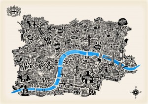
      Typographical Map of London

      glp_art_typographical_map_london

      The Typographical Map of London, created by artist Joao Fonte, shows central London as a collection of symbols and words, arranged in a topologically representative form to show the city’s structure in a novel way. We really like the way the artist has been careful in their choice, and number, of colours, these add significantly […]

      Continue reading »

      In Sydney, a white face can be a big help in a discriminatory housing market – CityMetric


      CityMetric

      In Sydney, a white face can be a big help in a discriminatory housing market
      CityMetric
      Finally, our map of the week – which, I’ll be honest, we do no justice to whatsoever – is this magnificent piece of work by Duncan Smith of UCL’s Centre for Advanced spatial Analysis. It shows, at a glance, the growth of all the world’s major cities

      and more »

      Continue reading »

      Alan Irwin talk on Citizen Science and Scientific Citizenship (JRC, October 2015)

      The EU Joint Research Centre in Ispra has recently released the recording of a talk by Alan Irwin at the Joint Research Centre as part of the STS “Contro  Corrente” series of seminars from 15 October 2015, with Jerome Ravetz and Silvio Funtowicz (famous for their post-normal science) as discussants. The talk, titled Citizen Science and Scientific Citizenship: same words, … Continue reading Alan Irwin talk on Citizen Science and Scientific Citizenship (JRC, October 2015)

      Continue reading »
      1 65 66 67 68 69 173