Picking Up Raster GIS Skills

Do you need to work with satellite images or datasets that are gridded? By gridded I mean data that are stored in grid like cells such as heights of the earth (or a digital elevation model), a global land cover map or gridded populations of the world? There are many other gridded datasets available, e.g. … Read more

Continue reading »

A Tale of Tech City: the future of Inner East London’s Digital Economy

Earlier this month Demos published a fascinating report on the hot topic of London’s “Tech City” cluster, which has been promoted by the government as a key growth pole for the UK. The report authors Max Nathan, Emma Vandore and Rob Whitehead, put the Inner East London cluster in the context of similar phenomena in … Continue reading »

Continue reading »

CASA: MRes Advanced Spatial Analysis and Visualisation

Below we provide full details for 2012 entry on the new MRes in Advanced Spatial Analysis and Visualisation (ASAV). The course reflects the current state of play in geographic, urban and architectural information systems with an emphasis on visual…

Continue reading »
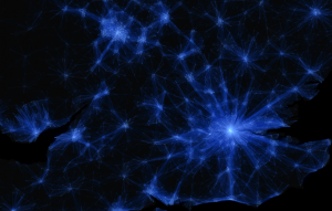
CASA: MRes Advanced Spatial Analysis and Visualisation

Below we provide full details for 2012 entry on the new MRes in Advanced Spatial Analysis and Visualisation (ASAV). The course reflects the current state of play in geographic, urban and architectural information systems with an emphasis on visual…

Continue reading »

2 Fully Funded PhD Studentships at CASA: Smart Cities / Smart Urban

We are pleased to announce 2 fully funded PhD studentships at the Centre for Advanced Spatial Analysis, University College London. Full details below, its a unique opportunity to carry out new cutting edge research in the field of smart cities: PhD 1 – CASA and The Greater London Authority Funding Type: Impact Award Project Title: PhD Studentship: […]

Continue reading »
1 2 3