TfL seeking permanent customer wi-fi data collection on the Tube – Rail Technology Magazine
TfL seeking permanent customer wi-fi data collection on the Tube Rail Technology Magazine
Continue reading »The latest outputs from researchers, alumni and friends at the UCL Centre for Advanced Spatial Analysis (CASA).
TfL seeking permanent customer wi-fi data collection on the Tube Rail Technology Magazine
Continue reading »TfL seeking permanent customer wi-fi data collection on the Tube Rail Technology Magazine
Continue reading »Wi-Fi use + big data analytics = better passenger journeys in London? SmartRail World
Continue reading »TfL seeking permanent customer wi-fi data collection on the Tube railtechnologymagazine.comTfL is looking to collect wi-fi data from passengers on a permanent basis across the full Tube network after a four-week trial revealed findings and p…
Continue reading »Wi-Fi use + big data analytics = better passenger journeys in London? SmartRail World”…could enable us to map the journey patterns of millions of passengers and understand in much greater detail how people move around…” A four week trial…
Continue reading »Once you switch the smartphone off from email and social media network, you can notice better when and how you’re crowdsourced. By this, I mean that use of applications to contribute data is sometimes clearer as the phone becomes less of communication technology and more of information technology (while most of the time it is … Continue reading Crowdsourced: navigation & location-based services![]()
|
Pilot shows how WiFi data can improve Tube journeys
WebWire (press release) Dr Hannah Fry from the Centre for Advanced Spatial Analysis at University College London, said: “By doing this study, TfL have demonstrated the very real way that big data can benefit us all. Using WiFi to understand how people are moving through … |
WebWire (press release) |
Pilot shows how WiFi data can improve Tube journeys
WebWire (press release) Dr Hannah Fry from the Centre for Advanced Spatial Analysis at University College London, said: “By doing this study, TfL have demonstrated the very real way that big data can benefit us all. Using WiFi to understand how people are moving through … |
PGRG Blog #2, September 2017 The Office for National Statistics (ONS) publishes detailed population estimates by ethnic group for areas in England and Wales following each census. However, there are currently no reliable population estimates by ethnic group available at the local authority level for the years since the 2011 census. Given the user interest … More ONS report: New approach for producing population estimates by ethnic group![]()
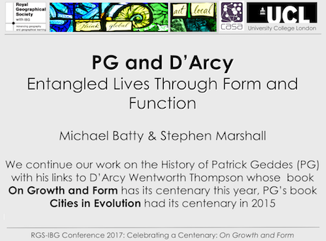
I hope more people (>2) see this post than actually attended the four lectures celebrating the contribution of D’Arcy Wentworth Thompson at this year’s RGS-IBG conference last Thursday when we presented. But such is the state of the world and … Continue reading →
Notes from two talks from the session on the role of expert knowledge. Details of the session in full are here. The potential of citizen science to inform expert understanding: a case study of an urban river in London Iain Cross (St Mary’s University, UK), Rob Gray (Friends of the River Crane Environment), Joe Pecorelli (Zoological … Continue reading RGS-IBG 2017 – The role of expert knowledge in socio-environmental policy and decision making![]()
These are notes from some of the talks from the two sessions on Just air? during the RGS-IBG conference in 2017. Details of the sessions are available here and here. Passive, reactive and participatory governance of the air: three approaches under scrutiny Nicola Da Schio, Bas Van Heur (Vrije Universiteit Brussel, Belgium) Looking at infrastructures, … Continue reading RGS-IBG 2017 – Just air? Spatial injustices, contestation and politicisation of air pollution (session notes)![]()
A new book on data and big data in the city edited by Rob Kitchin, Tracey P. Lauriault, Gavin McArdle from Routledge. Lot of very interesting material here on the data revolution in cities. Smart cities concepts are explained and critiqued … Continue reading →
As part of a presentation I gave yesterday at the RSAI-BIS (Regional Science Association International – British & Irish Section) annual conference on DataShine Travel to Work maps, I outlined the following eight techniques to avoid swamping origin/destination (aka flow) maps with masses of data, typically shown as straight lines between each pair of locations. … Continue reading Eight Ways to Better Flow Maps →
Continue reading »This map created by illustrator Mike Hall (who we’ve featured before) for Penguin Books, shows the locations in London that featured in John le Carré’s George Smiley spy novels. This is a lovely map, drawn from scratch and using a distinctive yellow/green and pastel blue pastel colour palette that evokes classic literary works and hand-printed […]
Continue reading »
Geography Review is a brand new magazine for sixth formers (grade 12-13 in the US) studying any subject but particularly those who are interested in geography. In the UK geography is one of the top subjects in high school and … Continue reading →
PGRG Blog #1, August 2017 Welcome to the first blog of the Population Geography Research Group! We are delighted to be launching this blog and our new-look website at the Annual Conference of the RGS-IBG in London next week. Do come along to the launch and share a celebratory drink (Launch and AGM: Wednesday 30th … More Our first PGRG blog post![]()
Abstract:
Big Data (BD) offers researchers the scope to simulate population behavior through vastly more powerful Agent Based Models (ABMs), presenting exciting opportunities in the design and appraisal of policies and plans. Agent-based simulations capture system richness by representing micro-level agent choices and their dynamic interactions. They aid analysis of the processes which drive emergent population level phenomena, their change in the future, and their response to interventions. The potential of ABMs has led to a major increase in applications, yet models are limited in that the individual-level data required for robust, reliable calibration are often only available in aggregate form. New (‘big’) sources of data offer a wealth of information about the behavior (e.g. movements, actions, decisions) of individuals. By building ABMs with BD, it is possible to simulate society across many application areas, providing insight into the behavior, interactions, and wider social processes that drive urban systems. This chapter will discuss, in context of urban simulation, how BD can unlock the potential of ABMs, and how ABMs can leverage real value from BD. In particular, we will focus on how BD can improve an agent’s abstract behavioral representation and suggest how combining these approaches can both reveal new insights into urban simulation, and also address some of the most pressing issues in agent-based modeling; particularly those of calibration and validation.
Keywords: Agent-based models, Big Data, Emergence, Cities.
![]() |
| The growth in Agent-based modeling -from search results of Web of Science and Google Scholar. |
![]() |
| Hotspots of activity of Tweeter Users: Tweet locations and associated densities for a selection of prolific users. |
Full Reference:
Crooks, A.T., Malleson, N., Wise, S. and Heppenstall, A. (2018), Big Data, Agents and the City, in Schintler, L.A. and Chen, Z. (eds.), Big Data for Urban and Regional Science, Routledge, New York, NY, pp. 204-213. (pdf)

The Corporate Archives division of Transport for London recently held a short internal exhibition at their headquarters at Palestra, called “Mapping London” and showcasing new and old maps of London’s transport from the archive. Amongst the highlights included this Lego historic tube map. The Lego is modern but the map was one of the last […]
Continue reading »Building on our work on narratives and social media at the 15th International Symposium on Spatial and Temporal Databases (SSTD’17) we have a paper entitled: “Predicting the Evolution of Narratives in Social Media.” In the paper we discuss briefly the …
Continue reading »This artistic map of central London attractions was drawn by illustrator Andy Smith for Chiltern Railway, as part of a promotion to attract families into London during the summer holidays. We like the bold and unusual colour scheme for the map, of maroons, pinks and oranges. It’s fairly unusual to see the Thames in pink […]
Continue reading »Many ideas involving geospatial intelligence seems to be one of those things reserved in the world of academia and nerdy twerps sitting in board rooms fiddling with their test tubes and scintillating telescopes – however, this stereotype can’t be further from the truth. In fact, the concept is quite simple and readily understandable for mere […]
The post Debunking Fact from Fiction – What Goes On in the World of Geospatial Intelligence appeared first on GeoTalisman.
Continue reading »It’s a typical August day in London today, with the rain falling pretty heavily and at least one tube station closed due to flooding. London’s greatest long-term flooding threat, though, is from isothermal expansion of the world’s water (i.e. it needs slightly more space as it heats) due to climate change. The above map was […]
Continue reading »I recently stumbled upon a great dataset. It’s the first to provide comprehensive data for world city sizes as far back as 3700BC. The authors (Meredith Reba, Femke Reitsma & Karen Seto) write: How were cities distributed globally in the past? How many people lived in these cities? How did cities influence their local and regional […]
Continue reading »
“More than 900 million people or one third of the world’s urban population lives in either slum or squatter settlements. Urbanization rates in developing countries are often so rapid that formal housing development cannot meet the demand. In the past decades, international, national and local development communities have taken several policy actions in an attempt to improve the living conditions of people within slums or to eradicate them completely. However, such policies have largely failed and slum-free cities have remained a distant goal for many developing countries. This chapter argues that for informed policymaking, it is important to investigate questions related to slum formation such as: (1) How do slums form and expand? (2) Where and when are they formed? (3) What types of structural changes and/or policy interventions could improve housing conditions for the urban poor? In order to address these questions, this chapter develops a geosimulation model that is capable of exploring the spatio-temporal dynamics of slum formation and simulating future formation and expansion of slums within cities of the developing world. Our geosimulation model integrates agent-based modeling (ABM) and Geographic Information System (GIS), methods that are often applied separately to explore slums. In our model, ABM simulates human behavior and GIS provides a spatial environment for the housing market. GIS is also used to analyze empirical data using spatial analyses techniques, which is in turn used to validate the model outputs. The core of this framework is a linked dynamic model operating at both micro and macro geographic and demographic scales. The model explores the collective effect of many interacting inhabitants of slums as well as non-slum actors (e.g. local government) and how their interactions within the spatial environment of the city generate the emergent structure of slums at the macro scale. We argue that when empirical data is absent, geosimulation provides useful insights to study implications of various policies. The goal of this framework is to develop a decision support tool that could allow urban planners and policymakers to experiment with new policy ideas ex-ante in a simulated environment. We calibrate and validate the model using data from Ahmedabad, the sixth largest city of India, where 41% of its population lives in slums. This is one of the first attempts to develop an integrated and multi-scalar analytical framework to tackle slum issues in the developing world at multiple spatial scales.”
Keywords: Slums Agent-based modeling India Geosimulation
![]() |
| Integrated Simulation Framework |
![]() |
| Slum Locations and Slum Sizes in Ahmedabad, 2001 |
![]() |
| Spatial Sprawl Experiment |
Patel, A., Crooks, A.T. and Koizumi, N. (2018). “Spatial Agent-based Modeling to Explore Slum Formation Dynamics in Ahmedabad, India” in Thill J.C. and Drajicavic, S. (eds.), Geocomputational Analysis and Modeling of Regional Systems, Springer, New York, NY, pp 121-141. (pdf)
Further details of the model and project can be found here. As normal any thoughts and comments are most welcome.
Continue reading »Just a short post to highlight Rohan Fisher’s excellent website demonstrating and sharing a number of NetLogo models. One such example is shown below, which integrates GIS cost distance analysis to explore access to services via travel times (click her…
Continue reading »The means to produce are changing. The chimneys stopped smoking during the past century, and large industries increasingly are replaced by distributed production lines. Production is coming to a desk near you. These new ways of producing, such as 3d …
Continue reading »Executive People |
Hoe realiseert u digitale transformatie met analytics?
Executive People Dr Hannah Fry, lecturer in ‘the Mathematics of Cities’ bij het Centre for Advanced Spatial Analysis van UCL (University College London). Fry bestudeert patronen in menselijk gedrag in stedelijke gebieden. Haar onderzoeksgebieden lopen uiteen van … |
Dutch IT-channel |
SAS organiseert Analytics Experience
Dutch IT-channel Dr Hannah Fry, lecturer in ‘the Mathematics of Cities’ bij het Centre for Advanced Spatial Analysis van UCL (University College London). Fry bestudeert patronen in menselijk gedrag in stedelijke gebieden. Haar onderzoeksgebieden lopen uiteen van … |
There has been a resurgence of interest in data visualizations inspired by Joy Division’s Unknown Pleasures album cover. These so-called “Joy Plots” are easier to create thanks to the development of the “ggjoy” R package and also some nice code posted using D3. I produced a global population map (details here) using a similar technique in 2013 and since […]
Continue reading »