|
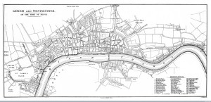
| The book cover of ‘Cities of Tomorrow: An Intellectual History of Urban Planning and Design in the Twentieth Century’ |
Yesterday I was surprised when I searched some new journal articles through UCL library’s E-Journal service. Volume85, Number 5, 2014 of Town Planning Review that was published just some days ago includes a new paper of Professor Peter Hall. Unfortunately, it is still unable to look through the UCL service, ‘And one fine morning -’: reflections on a double centenary, the paper can arouse the glad to read his words as well as the grief losing a great urbanist who passed away on 30 July 2014.
I, had trained as an architectural designer, started to have an interest in urban studies after reading one of his tremendous books ‘Cities of Tomorrow: An Intellectual History of Urban Planning and Design in the Twentieth Century.’ The book carefully and attractively introduced the history of modern cities from the 19th century to the end of the 20th century and it unveiled hidden stories that had built on the characteristics of each city step by step. The most interesting point what I found in this book, his vision for the city is not heading for built forms, but alternative society as Ebenezer Howard pursued. And it was entirely enough to bring the young student to London.
After I have entered The Bartlett, UCL, I had the opportunity to audit his seminar class for masters’ students. Every week, students groups analysed urban problems of particular cities in the world and studied how urban policies have intervened in the problems. When I listened his comments in the class, I could imagine Kung-Fu masters who simply overwhelmed many fighters in the movie what I watched long years ago . He looked like he knew everything about cities, and he was thoroughly conversant with geographical, economic and social issues from European cities to Sydney, Singapore and Global South.
Recently, Regional Studies that Peter Hall worked as the first editor published a virtual special issue to commemorate him. In the editorial page, Nicholas A. Phelps and Mark Tewdwr-Jones admire him highly as the academic who “successfully brought together in his career – history, geography and planning” and explained his achievements based on his articles in the issue that you can freely access.
I have made the list of his recent books.
Good Cities,Better Lives: How Europe Discovered the Lost Art of Urbanism
Also I have checked his lecture videos on online.
Youtube and Vimeo contain some his lectures, but the following videos might be useful to watch.
Hope this post could be helpful to remember Professor Peter Hall and his works
Continue reading »