Geographies of Co-Production: highlights of the RGS/IBG ’14 conference

The 3 days of the Royal Geographical Society (with IBG) or RGS/IBG  annual conference are always valuable, as they provide an opportunity to catch up with the current themes in (mostly human) Geography. While I spend most of my time in an engineering department, I also like to keep my ‘geographer identity’ up to date as this […]

Continue reading »

Herding Sheep

http://www.bbc.com/news/science-environment-28936251
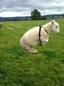
Have you ever wondered how a farmer and a single sheep dog can herd sheep? A recent paper in Journal of the Royal Society Interface explains just how. Using GPS data from collars researchers have developed a computational model which  “reproduces key features of empirical data collected from sheep–dog interaction”. The model has two simple rules:

“The first rule: The sheepdog learns how to make the sheep come together in a flock. The second rule: Whenever the sheep are in a tightly knit group, the dog pushes them forwards.” (BBC)

The movie below (which accompanies the paper) shows some simulation runs with different numbers of agents. The shepherd (blue) approaches and rounds up the agents/sheep (black dots) and then proceed to herd the group toward the target.

Full Reference:

Strömbom. D. Mann, R. P., Wilson, A. M., Hailes, S., Morton, A. J., Sumpter, D. J. T., King, A. J. (2014) Solving the shepherding problem: Heuristics for herding autonomous, interacting agents. Journal of the Royal Society Interface, 11: 20140719.

Thanks to @Badnetworker for drawing my attention to this.

Continue reading »

Opportunities at St Andrews for Population Researchers

TweetThree positions in Human Geography – ML1317 Details: The Department of Geography and Sustainable Development at St Andrews invites applications for three posts in Human Geography (from Lecturer to Professor). Exceptional candidates will be considered for Reader or Professorial positions. We welcome applications from candidates at all career stages who are, or have the potential […]

Continue reading »

OpenStreetMap studies (and why VGI not equal OSM)

As far as I can tell, Nelson et al. 2006 ‘Towards development of a high quality public domain global roads database‘ and Taylor & Caquard 2006 Cybercartography: Maps and Mapping in the Information Era are the first peer review papers that mention OpenStreetMap. Since then, OpenStreetMap received plenty of academic attention. More ‘conservative’ search engines such as ScienceDirect […]

Continue reading »

How making London greener could make Londoners happier – interactive map – The Guardian

How making London greener could make Londoners happier – interactive map
The Guardian
London – with all its tarmac, brick and glass – is actually 38.4% open space and ranks as the world’s third greenest major city. Now Daniel Raven-Ellison wants to go further … and make Greater London a national park. His campaign and online petition

Continue reading »

Happy 10th Birthday, OpenStreetMap!

Today, OpenStreetMap celebrates 10 years of operation as counted from the date of registration. I’ve heard about the project when it was in early stages, mostly because I knew Steve Coast when I was studying for my Ph.D. at UCL.  As a result, I was also able to secured the first ever research grant that focused […]

Continue reading »

Borough Tops

The Diamond Geezer is, this month, climbing the highest tops in each one of London’s 33 boroughs. To find the highest points, he’s used a number of websites which list the places. These derive the data from contour lines, perhaps supplemented with GPS or other measurements. However, another interesting – and new – datasource for […]

Continue reading »