Interactive Maps within React.js

Recently, I have been teaching a Full-stack development bootcamp at CodeOp (great experience!). When the students reached project phase, I was very pleased to see a lot of interest in using maps. And that is easy to understand, right? geospatial … Continue reading

Continue reading »

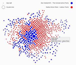
Data Maps with Force Layout

forcelondon_2

Alexander Brett has created this interactive map of London using the D3 visualisation framework and its “Force Layout” view. This places the data points (London ward centroids) at their geographic origin, and then applies a series of competing forces, as if the points are connected by a mesh of springs, to subtly adjust the locations […]

Continue reading »