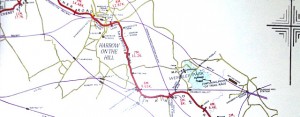
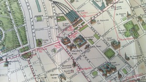
Green Wedges
This map, “A Plan for Greater London”, is a […]
Continue reading »The latest outputs from researchers, alumni and friends at the UCL Centre for Advanced Spatial Analysis (CASA).
This map, “A Plan for Greater London”, is a […]
Continue reading »The London Railway Atlas is probably the most detailed […]
Continue reading »From Geographicus, a US map dealer, by way of a tweet b […]
Continue reading »Here is an interesting concept by illustrator Russell B […]
Continue reading »This map, created by illustrator/designer Mike Hall (we […]
Continue reading »This colourful, much adorned map was produced as a fold […]
Continue reading »Published in 1913 (and available to download from the W […]
Continue reading »The Wellcome Image Library contains a number of interes […]
Continue reading »The National Library of Scotland’s (NLS) Map Depa […]
Continue reading »John Snow’s map of cholera has become one of the […]
Continue reading »London has many networks – roads, tube trains, el […]
Continue reading »This animation shows how the roads in the London area f […]
Continue reading »This attractive hand-drawn map, by Adam Dant, is of the […]
Continue reading »We were pleased to recently receive a number of hi-reso […]
Continue reading »Earlier this week I did a “map swap” with M […]
Continue reading »I was intrigued by this blog post of a lovely looking m […]
Continue reading »This map (full size version) is a plate in “A His […]
Continue reading »The British Library has launched a portal to let people […]
Continue reading »This map is taken from an book “The Unification o […]
Continue reading »This decorative map was published in or around 1946, as […]
Continue reading »Above is a small part of the “Wonderground Map of […]
Continue reading »A great new resource has just been released by the Well […]
Continue reading »[Update – Links fixed to repoint to the correct version […]
Continue reading »Mapping London has always been most interested in moder […]
Continue reading »The above map is an extract from a reproduction of the […]
Continue reading »The epic graphic novel entitled “From Hell” […]
Continue reading »Here is part of a map, The Map of Roman Britain, Second […]
Continue reading »The London Blitz, from 1940-1941, was a traumatic event […]
Continue reading »A book, by author and illustrator David Fathers, has re […]
Continue reading »This is an extract of a map produced in 1928 for London […]
Continue reading »The same day that James received a historic picture map […]
Continue reading »I recently managed to get my hands on one of my favouri […]
Continue reading »The image above is a photo of part of a large map of Lo […]
Continue reading »We probably don’t feature enough old maps of Lond […]
Continue reading »After featuring many very modern maps on Mapping London […]
Continue reading »We were delighted to receive a copy of this rather bril […]
Continue reading »There is a shop in London that I always peer into when […]
Continue reading »As a followup to yesterday’s article on the Sovie […]
Continue reading »Yes the U.S.S.R. had its own maps of London, and other […]
Continue reading »