Locating London’s Past
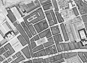
As an update to our previous feature on a replica map set of the John Rocque eighteenth century map of London, we feature the Locating London’s Past project. At the heart of the website is a high-resolution scanned version of the aforementioned historic map, allowing anyone to see this 260 270-year-old snapshot of (central) London […]
Continue reading »